
Dear adventurous readers, how about an adrenaline rush through white water rafting in the Philippines? Allow Tita S to tell you about it.
1.Cagayan de Oro1, or CDO, is a first class2 highly urbanized city3 in the Northern Mindanao4 region5 of the Philippines.
This city is actually geographically located in the province6 of Misamis Oriental7 but is governed administratively independent from the provincial government after it was classified as a highly urbanized city, on November 22, 1983, based on its annual income and population.
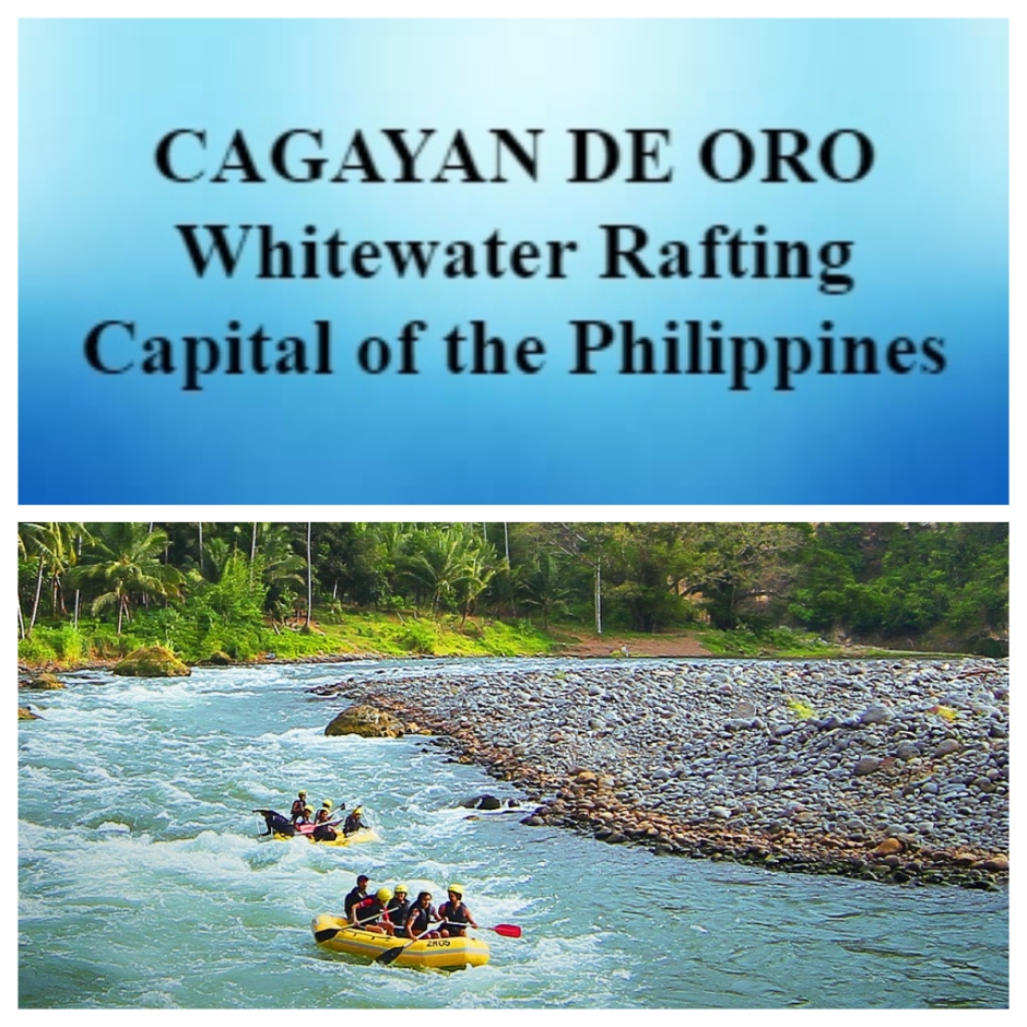
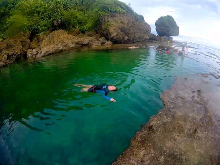
2. This city is called the Whitewater Rafting Capital of the Philippines because of the famous and exciting whitewater rafting adventures it offers along the Cagayan de Oro River (also called Cagayan River8).
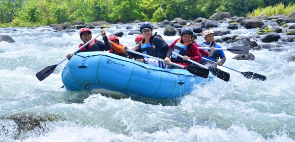
Photo source: Cagayan de Oro website – https://www.cagayandeoro.gov.ph/index.php/item/371-whitewater-rafting-adventure.html
Watch this 26-second video, taken from Cagayan de Oro Rafting – Kagay Outdoors’ Facebook, posted April 1, 2022: https://www.facebook.com/100063471889766/videos/728155551514012
The jump-off point for this activity is at Barangay9 Mambuaya, a 30-40 minute ride from the city proper.
3. Cagayan de Oro is the only city in the Philippines that offers rafting year-round. However, they say the best time to experience white water rafting is from July to December when the Cagayan de Oro River8 rages for a challenging, yet unforgettable, experience. Note that the peak wet season is June to October but just be aware of typhoons which might affect your travel plans.
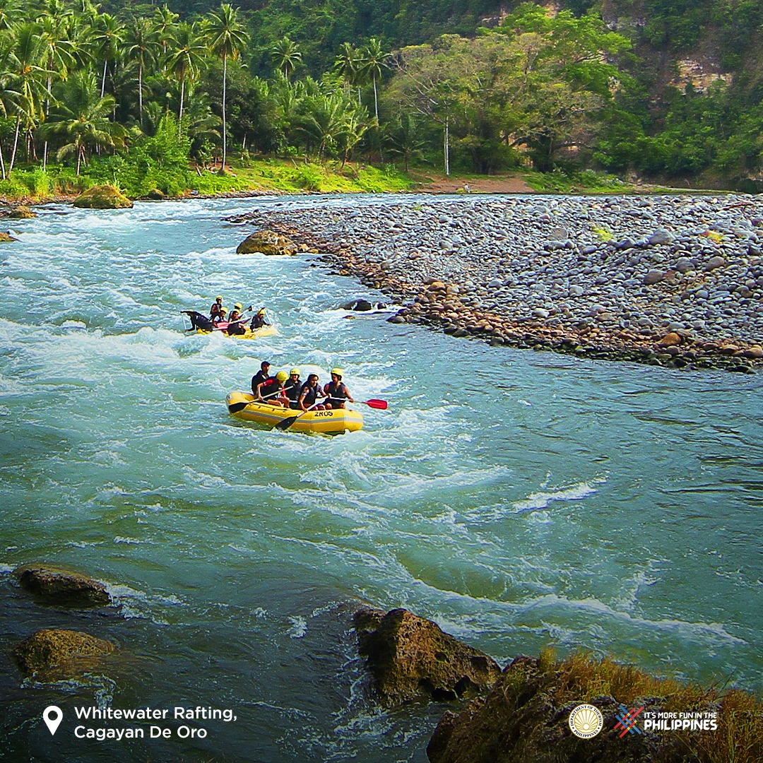
Photo source: Department of Tourism – Philippines’ Facebook. posted August 24, 2021 – https://www.facebook.com/itsmorefuninthePhilippines/photos/5882004878536988
4. This thrilling adventure is not for the faint of heart; some even consider it an extreme sport. The 48 km-ride of the Cagayan de Oro River takes 3-5 hours and you need to be physically fit to paddle and brave the turbulent waters of so many rapids, depending on the level of rafting you want (see item 7).
These rapids are separated with long and silent river flows for rafters to relax until they encounter the next rapids. You get to look around and appreciate the flora and fauna along the river. The guide may allow rafters to swim and enjoy the cool waters too.
The rapids are at an interval of not less than 15-19 minutes of each other.
This water adventure may include side trips of cave exploration and river trekking.
5. Here are some things you should know or do:
* It is an advantage if you know how to swim. Learn different swimming skills to be safe always during this adventure. A life vest is required for all in people in the boat, regardless of one’s level of swimming skills.
* Listen and remember all important details emphasized by your guide during the orientation in order to survive this activity as well as enjoy it. Always listen to the command of your guide while rafting.
* Hold your paddle firmly and properly; learn to control it.
* Learn and remember hand commands so you can easily know what to do, whether to stop or to paddle, to grip or stay calm, etc.
* Be calm in case something unfortunate happens. Do not panic; be in control and learn to balance yourself. Do not leave the boat even if the water looks calm. Implement and focus on all guidelines you were told during the orientation so you can overcome the situation to continue and finish this unforgettable adventure.
6. The minimum number of people per raft is 6, accompanied by 2 river guides. You can join a group to complete the number of people required per raft. For additional safety, a person in a kayak can accompany your raft, for a total of 3 trained guides.
7. Cagayan River’s depth, incline and rock formations make rafting an enjoyable experience for tourists. There are several White Water Rafting levels, starting with the beginner’s course, to advance and extreme. The former entails a 3-hour river run involving 14 rapids. The extreme course takes about 4 hours, with 24 rapids.
8. There are many water rafting groups to choose from. Their guides are trained by the Red Cross, Coast Guards, and the Department of Tourism. You can Google them, and preferably get referrals from satisfied tourists. It is advisable to book ahead of time.
9. What if you do not want to go rafting but still want to enjoy the Cagayan River8? Well, you have a choice. You can do river tubing, kayaking, or river trekking. The former allows you to ride a doughnut-shaped rubber tube; while the last two could be tiring. Nonetheless, all three are still fun and unforgettable!
10. The Department of Tourism and the city administration made Cagayan River activities as the banner tourism activities, highlighting whitewater rafting. The latter gained popularity through the years after President Gloria Macapagal-Arroyo and other famous personalities in the country underwent this challenging water adventure.
11. How do you get to Cagayan de Oro City1?
Cagayan de Oro is very accessible; you can go there by air, sea or land.
Those from Manila can ride any of the leading local airlines for 1 1/2 hours to Laguindingan Airport, which services CDO, 46 km (29 mi) away. Those from Cebu,
Clark, Davao or Iloilo can also go by air to this airport.
Visitors not in a hurry can ride a 2Go Travel boat for 32-35 hours from Manila to CDO Port, a modern international seaport. CDO is also accessible by sea from Bacolod; Jagna or Tagbilaran, Bohol; Cebu City, Dumaguete, Iloilo and Tagbilaran.
There are daily bus trips to CDO from Manila, just Google bus companies. However, it takes about 30-40 hours. CDO is also accessible by land from Butuan, Cebu, Davao City, North Cotabato, and Surigao. Nearby provinces also have buses which go to CDO.
12. What do you need to bring for this adventure?
* a dry bag to keep all your things dry
* wear a dri-fit outfit, preferably, to keep you cool and dry; wear a rash guard for protection from sunburn
* wear protective gears like a helmet (just in case you accidentally hit your head), elbow and knee pads
* apply sunblock 30 minutes before this activity
* extra comfortable activewear
* essentials – toiletries, medicine
* first aid kit
* potable water in your personal reusable water bottle
Be sure to coordinate with your tour operator what to bring, i.e., if they will provide all that you need for your whitewater rafting experience, or if you have to bring some personal swimming gear.
13. Where can you stay and how do you go around the city? There are many types of accommodations (hotels, hostels, B&Bs, condotels, inns, etc.) to choose from, depending on your budget. There are also many modes of public transportation as well. Just Google.
14. Where else can you go in CDO (alphabetically arranged)? The less adventurous tourists can also opt for less adrenaline rush but still enjoy their visit to CDO. The peak season is September to March. There are so many places to check out and so many activities for you and your family:
* Amaya View – paraglide, trek the city’s highest mountain peak, relax at the infinity pool, explore Noah’s Ark, option to glamp – see https://www.facebook.com/amayaview/
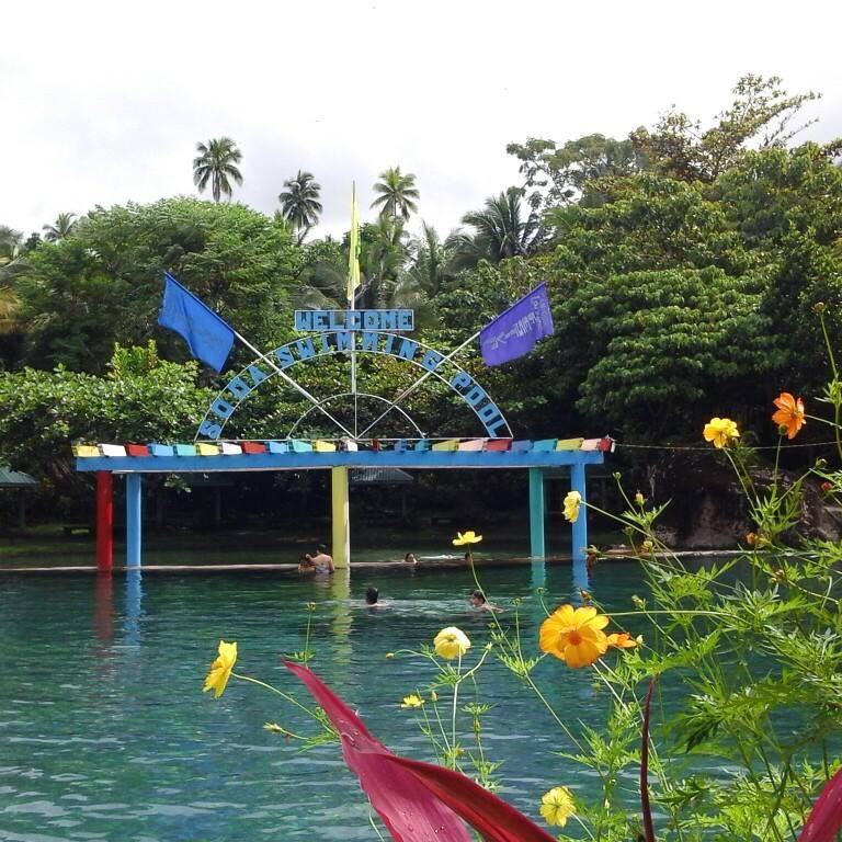
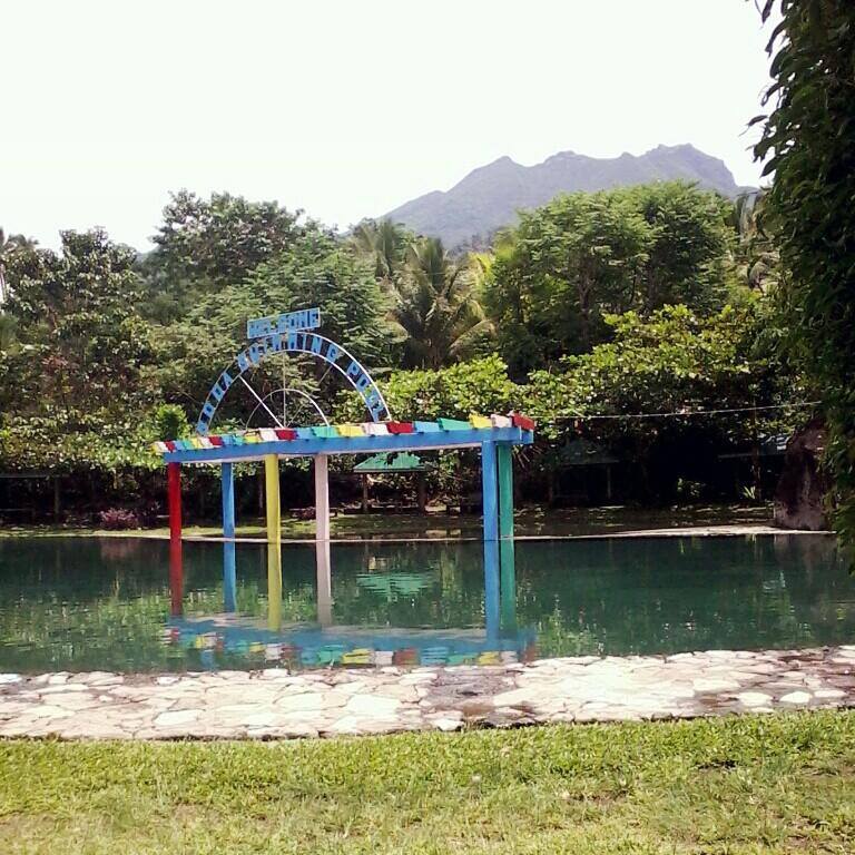
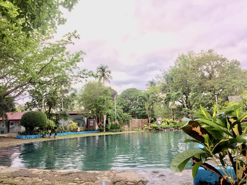
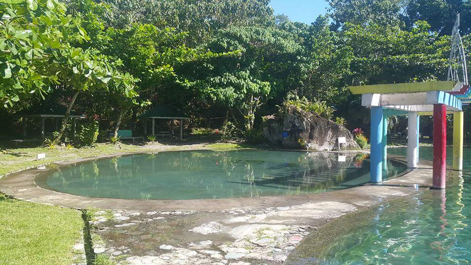
* Gardens of Malasag Eco-Tourism Village – swim in the swimming pool, appreciate the lush gardens and small zoo – contact: (088) 8855-6183 or (+63) 917-896-8873; visit gardensofmalasag@tieza,gov.ph
* Macahambus Adventure Park – zipline, trek, rappel – see https://www.facebook.com/people/Macahambus-Adventure-Park/100067209004898/
* Mapawa Nature Park – zipline, horseback ride, trek/hike, swim, enjoy waterfalls – see https://www.facebook.com/MapawaPark/
* Museo de Oro – appreciate archaeological and ethnic artifacts – see https://www.xu.edu.ph/museodeoro and https://www.facebook.com/xumuseodeoro/
* Museum of Three Cultures – appreciate 3 dominant cultures in the city – Maranao Muslims, Christians and indigenous people – see https://www.cu.edu.ph/museum-of-three-cultures/ and https://www.facebook.com/cu.museum/
* Seven Seas Waterpark – 12 water slides – see https://www.sevenseaswaterparkresort.com/ and https://www.facebook.com/sevenseaswaterpark/
* Saint Augustine Metropolitan Cathedral – see https://www.facebook.com/acdocathedral2019/
* Tubajon Aquamarine Park – kayak, swim, enjoy mangrove forest
The information was obtained from https://businessmirror.com.ph/2018/12/09/a-pumping-ride-in-the-famed-river-awaits-you-chasing-white-waters-in-cagayan-de-oro/, https://aboutcagayandeoro.com/cagayan-de-oro-tourist-spots-cagayan-de-oro/, https://www.discoverthephilippines.com/cagayan-de-oro-city-visitors-guide/ and https://philippines.travel/activities/white-water-rafting and the Wikipedia page “Cagayan River (Mindanao)”10.
The photo featured in the cover photo-collage was obtained from Department of Tourism – Philippines’ Facebook account – https://www.facebook.com/itsmorefuninthePhilippines/photos/5882004878536988
So, if you will visit Cagayan de Oro1, have I convinced you to try this thrilling and challenging water activity?
Heads up: Before planning to travel, always get updates regarding local government status, rules, restrictions and safety measures of the destination/s you want to visit, taking into consideration your personal health conditions and activity involved, and remember to level your expectations.
This is not a sponsored post. I just want my readers to know more about the Philippines.
Did you find this post informative? I would like to hear your comment/s regarding whitewater rafting in CDO, especially if you were able to experience it.
See other interesting places through other posts in this category and other categories of SCapades, Pinoy Delights, and Smart Traveler – Now You Know, Short and Simple, and Say, Say, Say. Happy reading, and I hope that you will appreciate what I shared and some of the featured destinations will be part of your future travel plans!
Remember to share this post with your Facebook friends, follow me by clicking on the bottom right corner of your device, and do not forget to like this post. Thank you.
– – – – – – – – – – – – – – – – – – – – – – – – – –
The following terms are defined for interested readers, especially those with “Senior-Moments”, those not familiar with Filipino terms, and those too busy or lazy to Google such terms:
1Cagayan de Oro (CDO) is a first class2 highly urbanized city3 located in the Northern Mindanao4 region5 of the Philippines. It is the capital of the province6 of Misamis Oriental7 where it is geographically situated but governed administratively independent from the provincial government. It became a town in 1871, a city on June 15, 1950, and a highly urbanized city on November 22, 1983. It has 80 barangays9 and is the 10th most populous city in the country. It serves as the regional center and business hub of the region. The city’s economy is largely based on industry, commerce, trade, service, and tourism. It is known for its white water rafting and is known as the “Whitewater Rafting Capital of the Philippines”. It is also know for kayaking adventures. It is located along the north central coast of the Mindanao11 group of islands, and is bordered to the north by Macajalar Bay facing the Bohol Sea, the municipalities12 of Opol to the west, Tagoloan and the province of Misamis Oriental to the east, and the provinces of Bukidnon and Lanao del Norte to the south.
The information was obtained from Wikipedia page “Cagayan de Oro”.13
2A 1st class city in the Philippines has an average annual income for the previous 4-year period of at least 500 million pesos, according to the Wikipedia page “Cities of the Philippines.”14
3A highly urbanized city (HUC) is a city with a minimum population of 200,000 inhabitants, as certified by the Philippine Statistics Authority, and with the latest annual income of at least PHP50 million or US$1 million, as certified by the City Treasurer. There are currently 33 such cities in the Philippines. The information was obtained from Wikipedia page “Cities of the Philippines”.14
See a related post: Foreign Seniors Ask: HOW MANY CITIES ARE THERE IN THE PHILIPPINES?
4Northern Mindanao, or Region X, is an administrative region5 in the north-central part of Mindanao11 group of islands. It comprises 5 provinces6: Bukidnon, Lanao del Norte, Misamis Occidental, Misamis Oriental7, the island-province of Camiguin, and 2 highly urbanized cities3 – Iligan and Cagayan de Oro1. The latter is the regional center.
It has a total land area of 2,049,602 ha. (5,064,680 acres), and more than 60% of this area are classified as forest land. Its seas abound with fish and other marine products. Its high elevation accounts for its cool climate and abundant vegetation.
The information was obtained from Wikipedia page “Northern Mindanao.”15
5A region is an administrative division based on geographical, cultural and ethnological characteristics. Each region is further subdivided in provinces6, composed of cities and municipalities12 (or towns), which in turn, are divided into barangays9, formerly called barrios, according to Wikipedia page “Regions of the Philippines” 16.
See a related post: Foreign Seniors Ask: WHAT ARE THE REGIONS OF THE PHILIPPINES?
6A province is the primary administrative and political division in the Philippines. It is the second-level administrative sub-division of a region5. There are 81 provinces (called lalawigan) in the Philippines. Each province is governed by an elected legislature called the Sangguniang Panlalawigan and by an elected governor. The information was obtained from Wikipedia page “Provinces of the Philippines.”17
See a related post: Foreign Seniors Ask: WHAT ARE PROVINCES IN THE PHILIPPINES?
7Misamis Oriental is a coastal province6 located in the Northern Mindanao4 region5 of the Philippines. It is the capital, provincial center and largest city of Cagayan de Oro1, and is governed independently. It was founded in 1939. It has a total land area of 3,131.52 sq.km. (1,209.09 sq.mi.), excluding Cagayan de Oro. It comprises 23 municipalities12 and 2 component cities18 (El Salvador and Gingood). It is bordered on the north by the Bohol Sea, with the island-province of Camiguin just off its northern coast, the provinces of Lanao del Norte on the west, Agusan del Norte on the east, and Bukidnon on the south.
Cebuano is the primary spoken language of this province but many are fluent in Tagalog and English, which are mainly used for business, education and administration. Maranao is also spoken among the Maranao communities within the province.
The information was obtained from Wikipedia page “Misamis Oriental.”19
8Cagayan River, or Cagayan de Oro River, is one of the rivers draining the northern central part of the island of Mindanao11 in the Philippines. The name comes from the word Kagay which means “river” so Kagayan means “a place with a river”. Its mouth is located in Cagayan de Oro. It traverses the municipalities12 of Baungon, Libona and Talakag, connecting tributaries along the way, and finally empties into the Macajalar Bay at Cagayan de Oro1. The main tributaries of this river are: Bubunaoan River, Kalawaig River, Tagite River and Tumalaong River.
It serves as the natural boundary between the provinces6 of Bukidnon and Iligan, and between Bukidnon and Cagayan de Oro. This river is a very popular site for whitewater rafting in the Philippines and is promoted by the Department of Tourism as the main tourist attraction of Cagayan de Oro.
The information was obtained from Wikipedia page “Cagayan River (Mindanao).”10
9A barangay in the Philippines is the smallest administrative division in the Philippines, headed by a barangay captain, aided by a Sangguniang Barangay (Barangay Council). It is the native Filipino term for a village. It was formerly called a barrio. In a metropolitan area, a barangay is an inner city neighborhood, a suburb, or a suburban neighborhood. The word barangay originated from the term balangay, a kind of boat used by a group of Austronesian people who migrated to the Philippines. A number of barangays grouped together is called a district. The information was obtained from Wikipedia page “Barangay.”20
10“Cagayan River (Mindanao),” accessed April 8, 2022, https://en.wikipedia.org/wiki/Cagayan_River_(Mindanao)
11Mindanao is one of the 3 major geographical divisions of the Philippines. It is the second largest island of the country and covers 6 administrative regions5: Caraga, Davao, Northern Mindanao4, SOCCSKSARGEN, Zamboanga Peninsula, and the Bangsamoro Autonomous Region in Muslim Mindanao (BARMM). It is composed of 22 provinces6 and 33 cities (27 provinces and 33 cities, if associated islands are included). The information was obtained from Wikipedia page “Mindanao.”21 Mindanao is located in the southern part of the country; the 2 other geographical divisions of the Philippines are Luzon (in the northern part) and Visayas (the middle part).
12A municipality is a small, single urban administrative division in the Philippines which has corporate status and powers of self-government or jurisdiction as granted by law. It is a unit under a province6, subdivided into barangays9, and is called town, or bayan. In the Philippines, a municipality is headed by a mayor, a vice mayor and members of the Sangguniang Bayan (legislative branch). The information was obtained from Wikipedia page “Municipalities of the Philippines.”22
13“Cagayan de Oro,” accessed April 8, 2022, https://en.wikipedia.org/wiki/Cagayan_de_Oro
14“Cities of the Philippines,” accessed April 2, 2018,
https://en.wikipedia.org/wiki/Cities_of_the_Philippines
15“Northern Mindanao,” accessed April 2, 2018, https://en.wikipedia.org/wiki/Northern_Mindanao
16“Regions of the Philippines,” accessed July 17, 2018, https://en.wikipedia.org/wiki/Regions_of_the_Philippines
17“Provinces of the Philippines,” accessed April 2, 2018, https://en.wikipedia.org/wiki/Provinces_of_the_Philippines
18A component city is a type of city in the Philippines which does not meet the requirements of a highly urbanized city3 and is under the jurisdiction of a province6. If such a city is located along the boundaries of 2 or more provinces, it shall be considered part of the province of which it used to be a municipality12. The information was obtained from the Wikipedia page “Cities of the Philippines.”14
19“Misamis Oriental,” accessed February 2, 2021, https://en.wikipedia.org/wiki/Misamis_Oriental
20“Barangay,” accessed July 9, 2018, https://en.wikipedia.org/wiki/Barangay
21“Mindanao,” accessed April 2, 2018, https://en.wikipedia.org/wiki/Mindanao
22“Municipalities of the Philippines” accessed April 2, 2018, https://en.wikipedia.org/wiki/Municipalities_of_the_Philippines

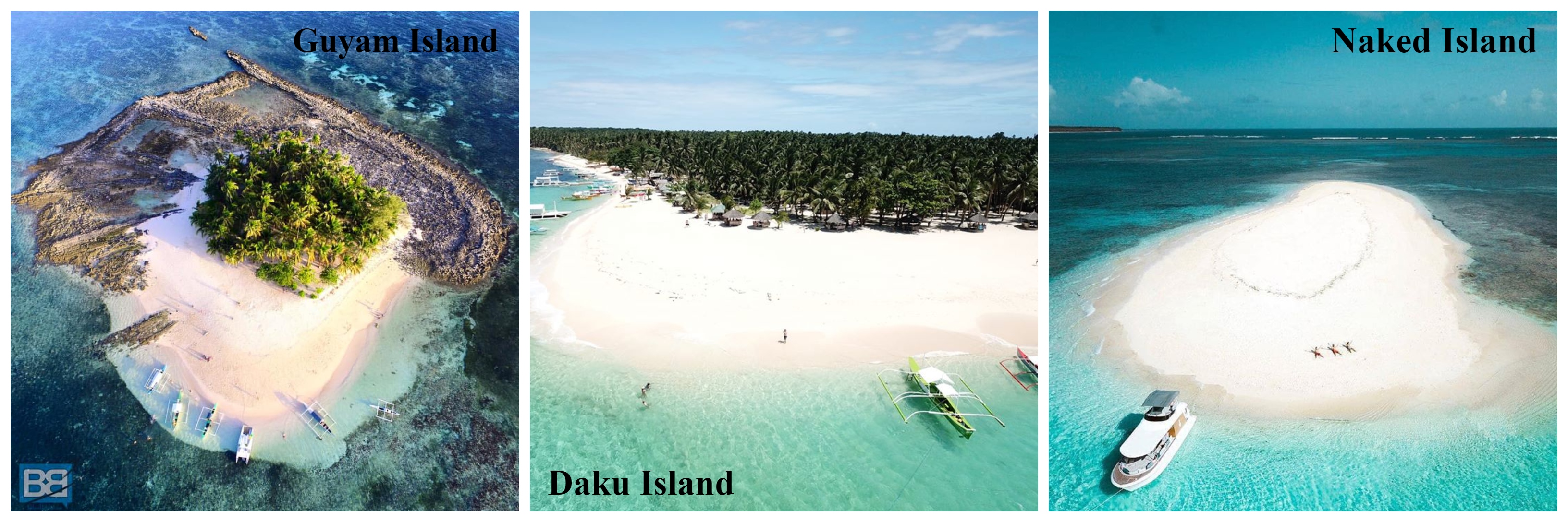

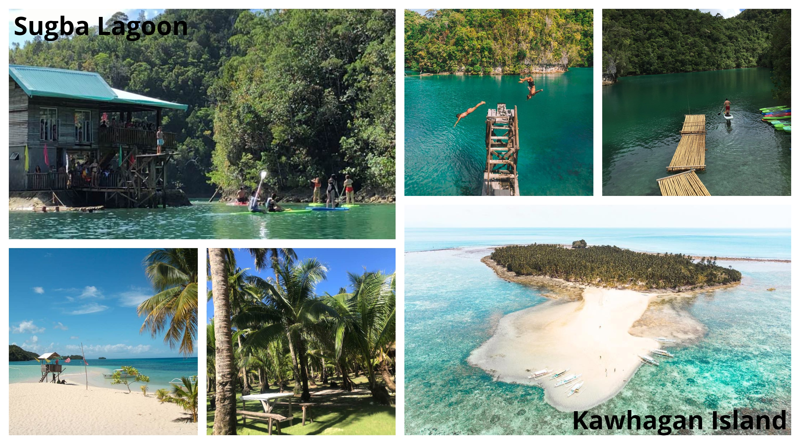


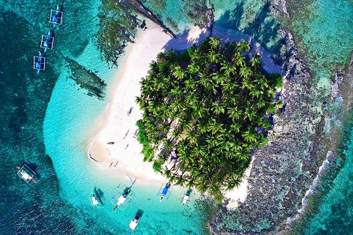
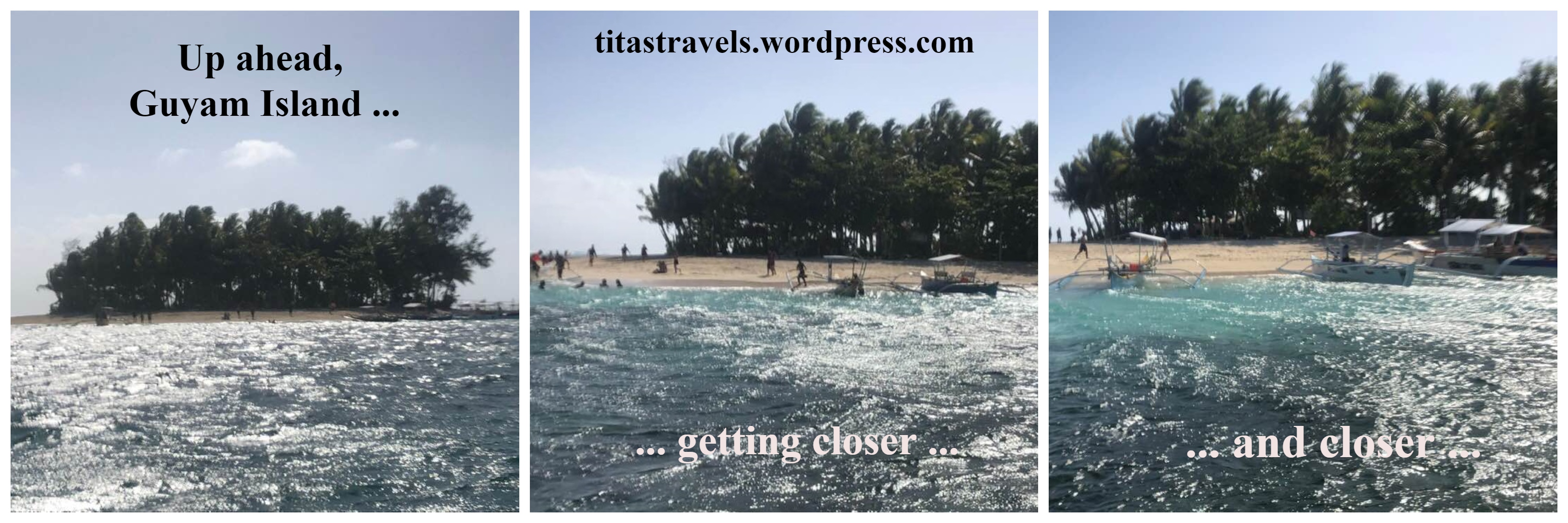
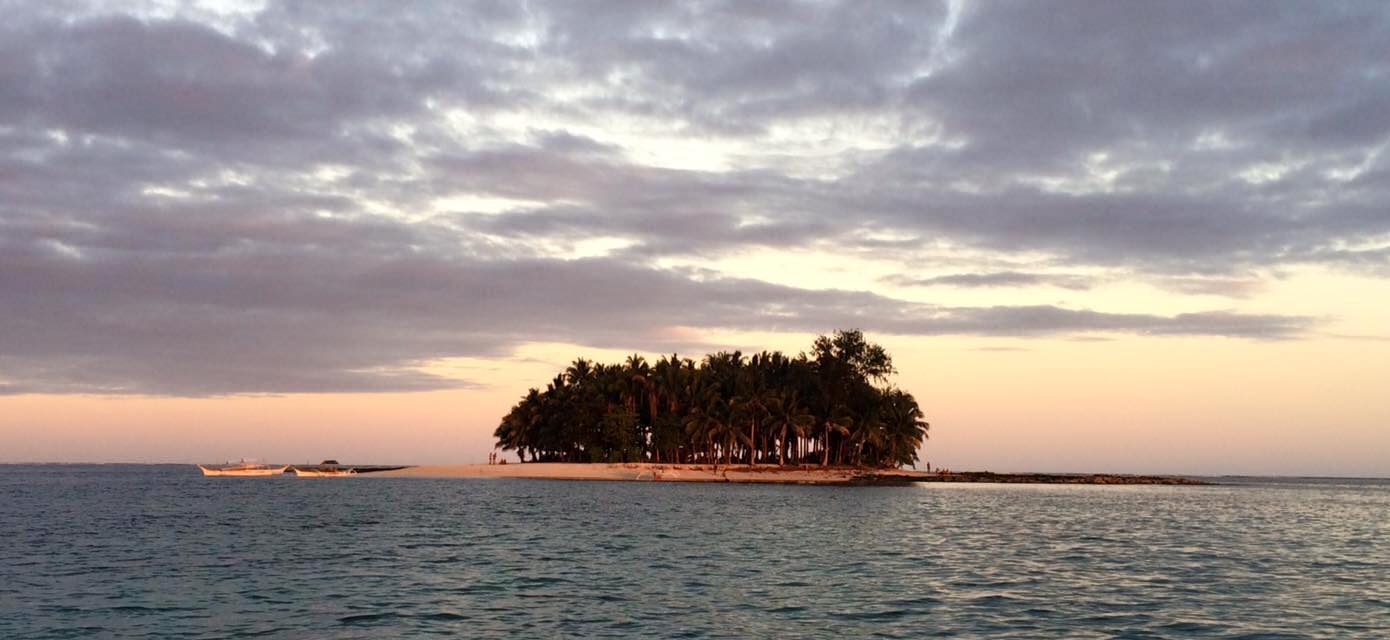 Guyam Island, Siargao – Source:
 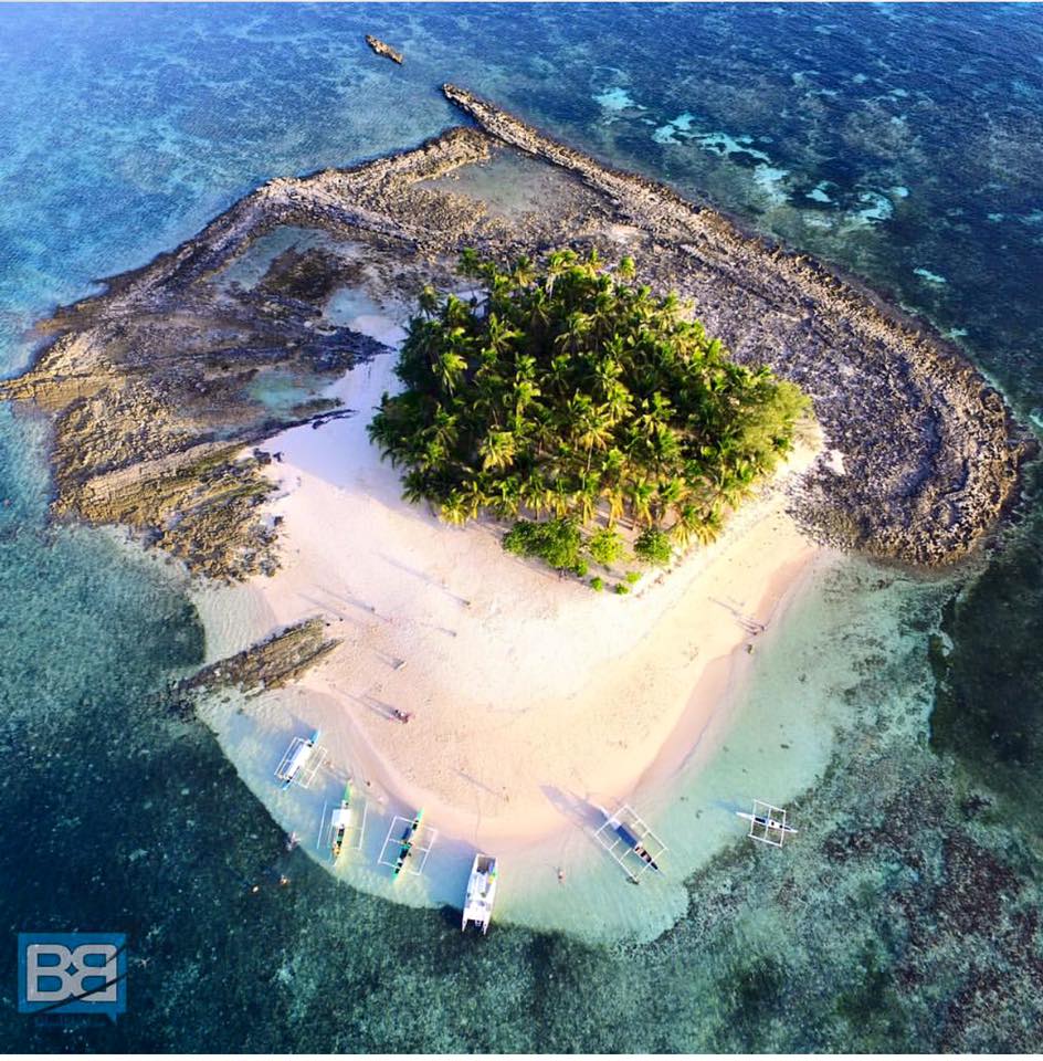 Guyam Island, Siargao – Source:
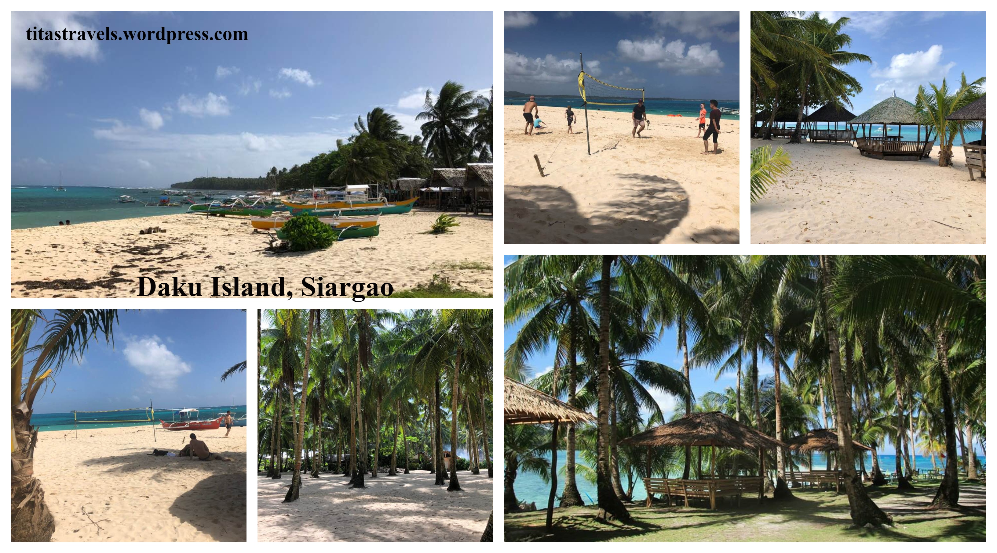
 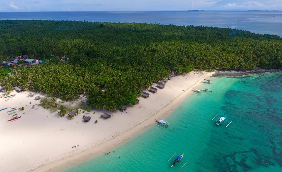 Daku Island, Siargao – Source:
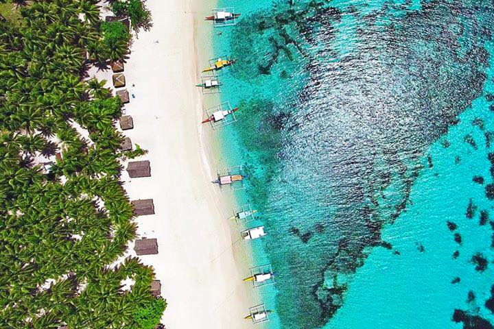
 Daku Island, Siargao – Source:
  Daku Island, Siargao – Source:
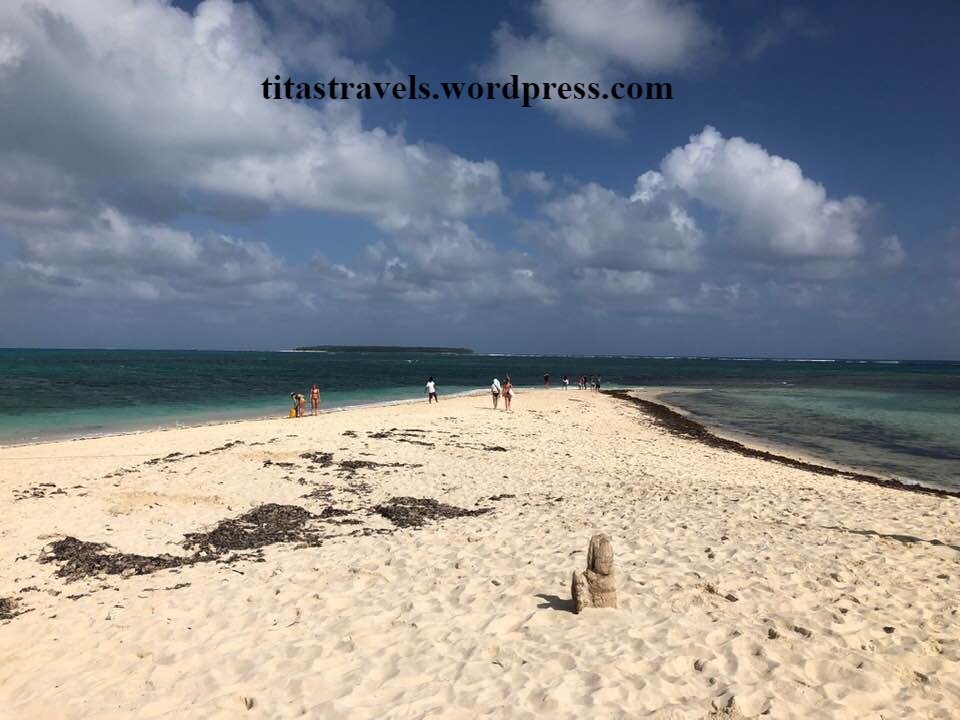
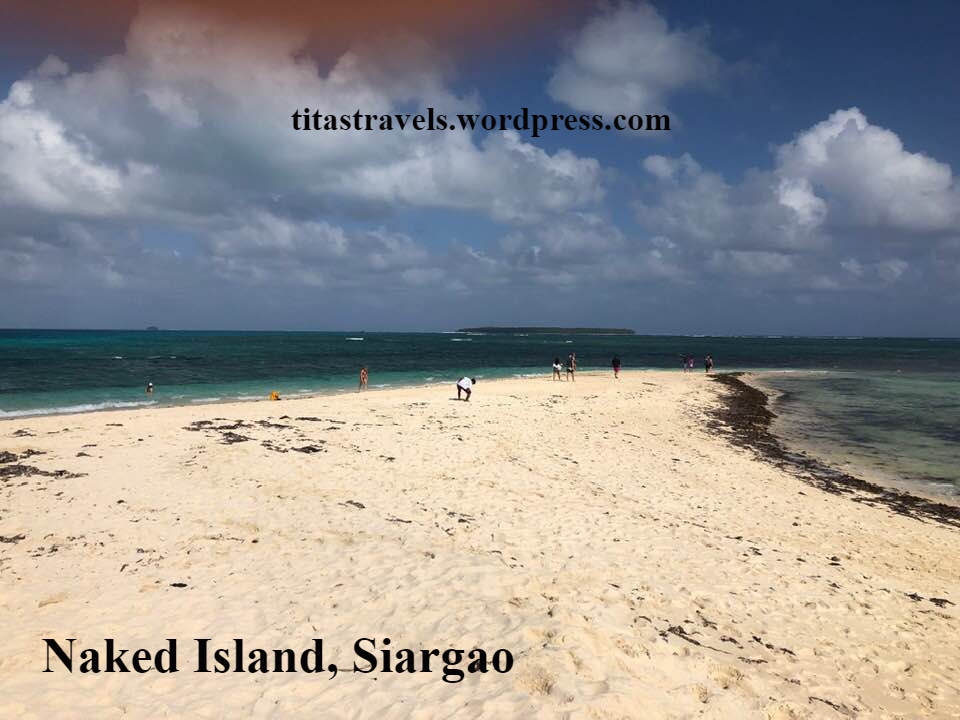
  Naked Island, Siargao – Source:
 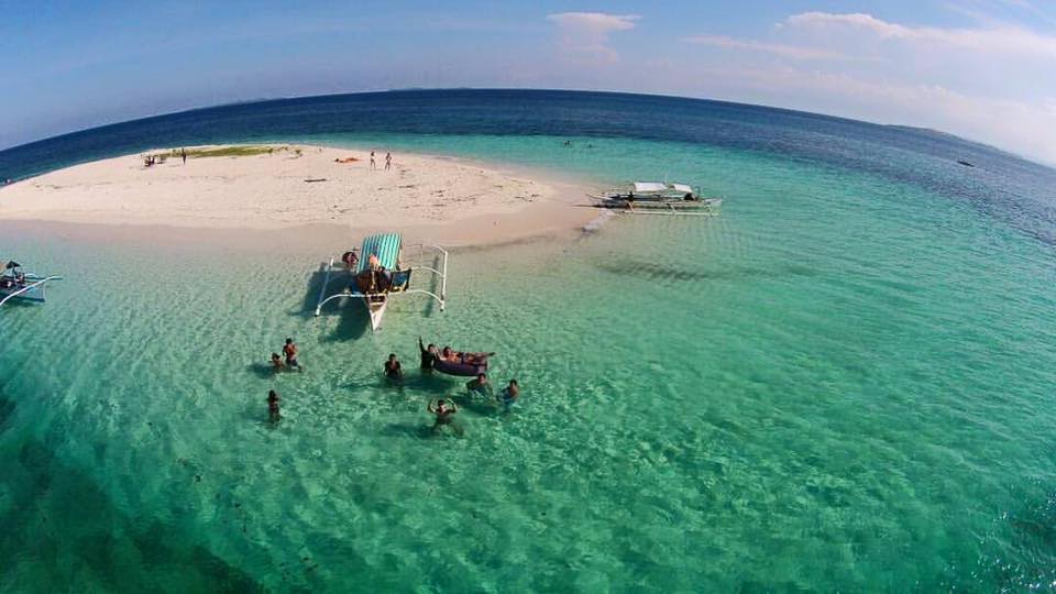 Naked Island, Siargao – Source:
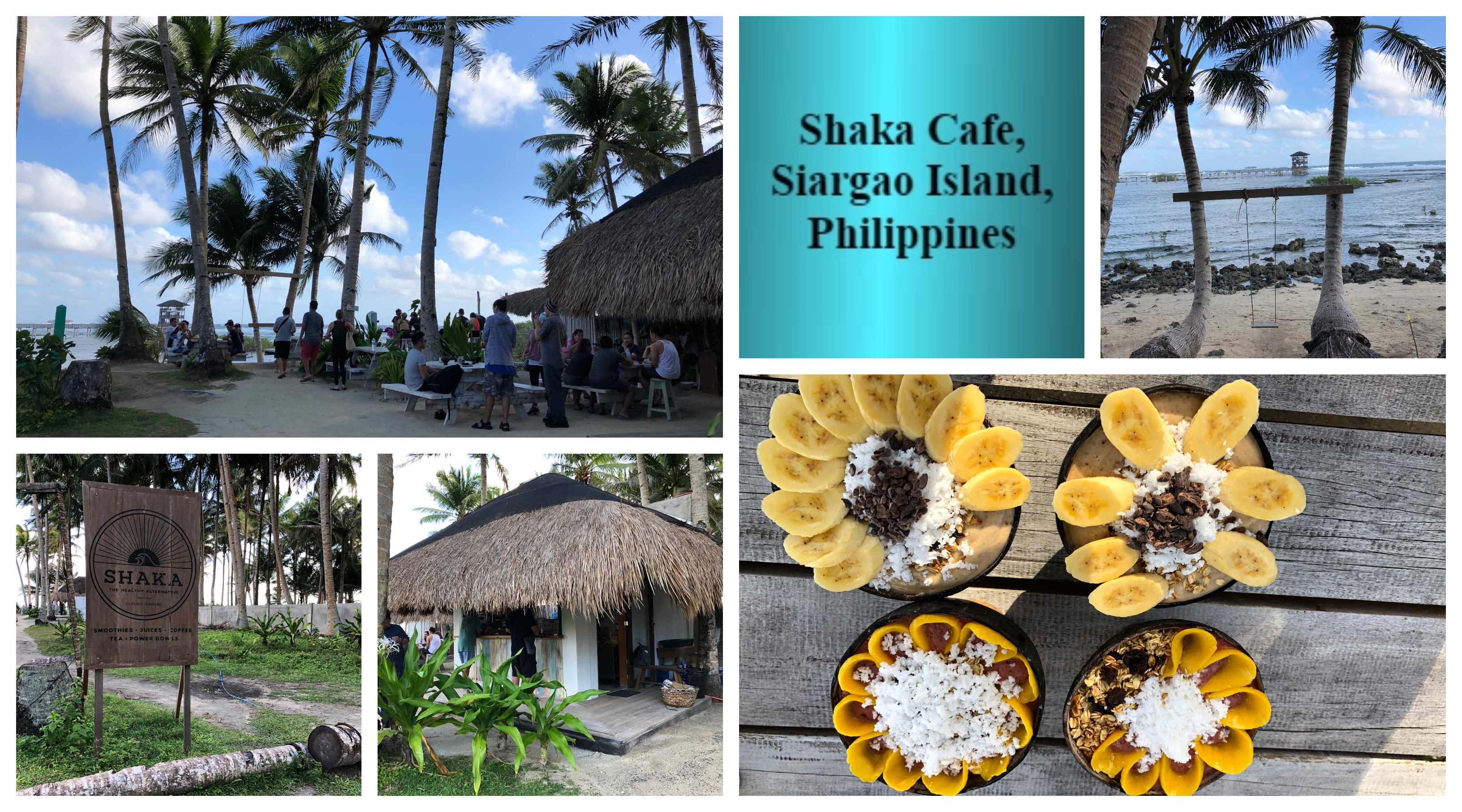
 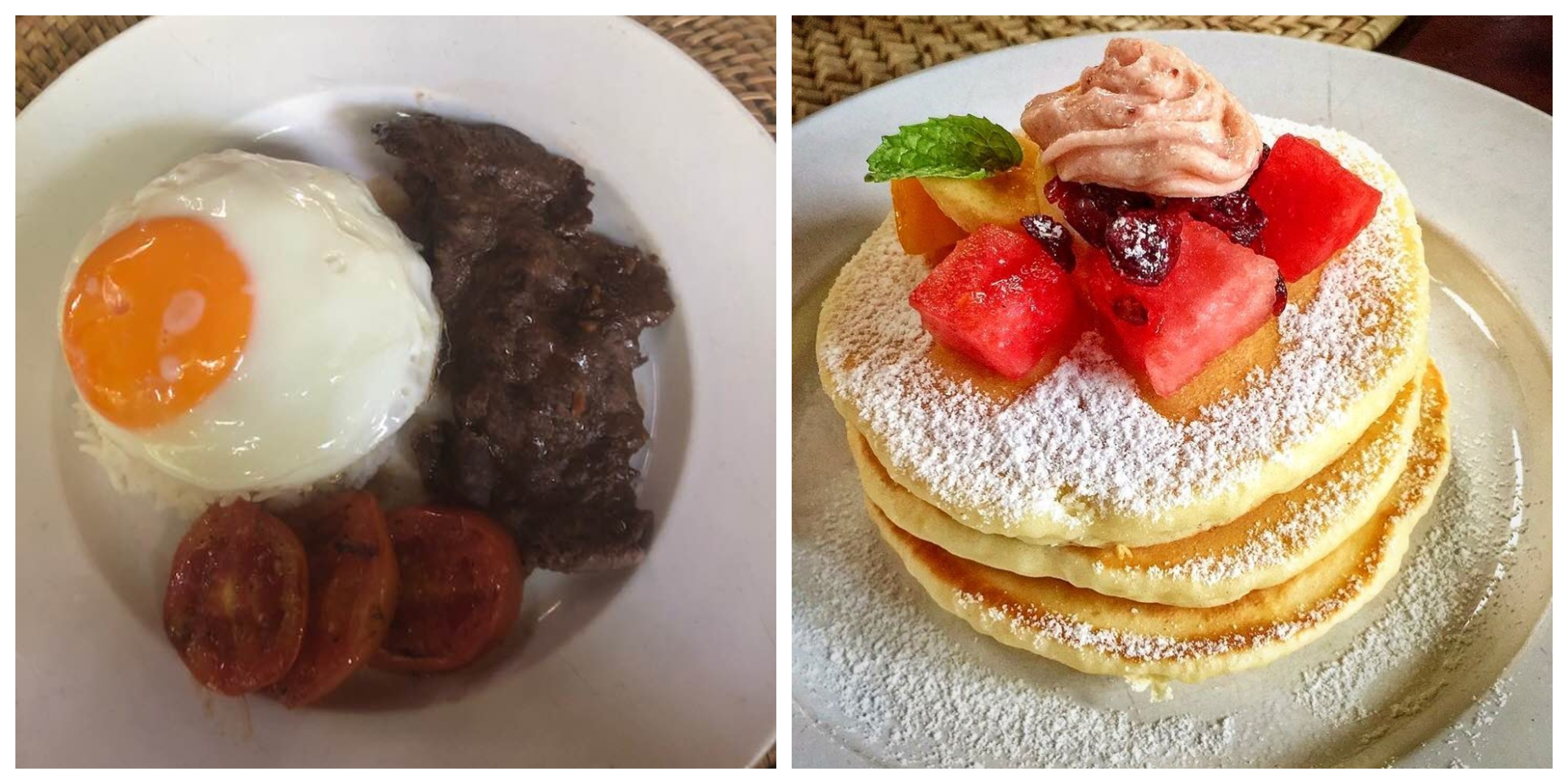 All adults ordered the Filipino Breakfast – Tapa (fried, marinated beef), rice, and fried egg. Our grandchild ordered Kermit Pancakes – three stacks of pancakes with fruits in season, butter and maple syrup. I took the picture on the left and I got the picture on the right from the Facebook account of Kermit –
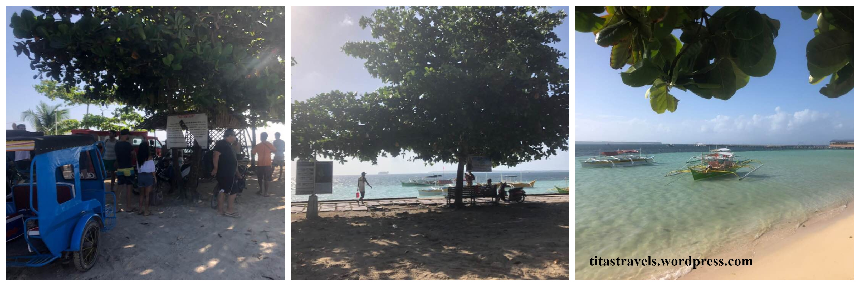
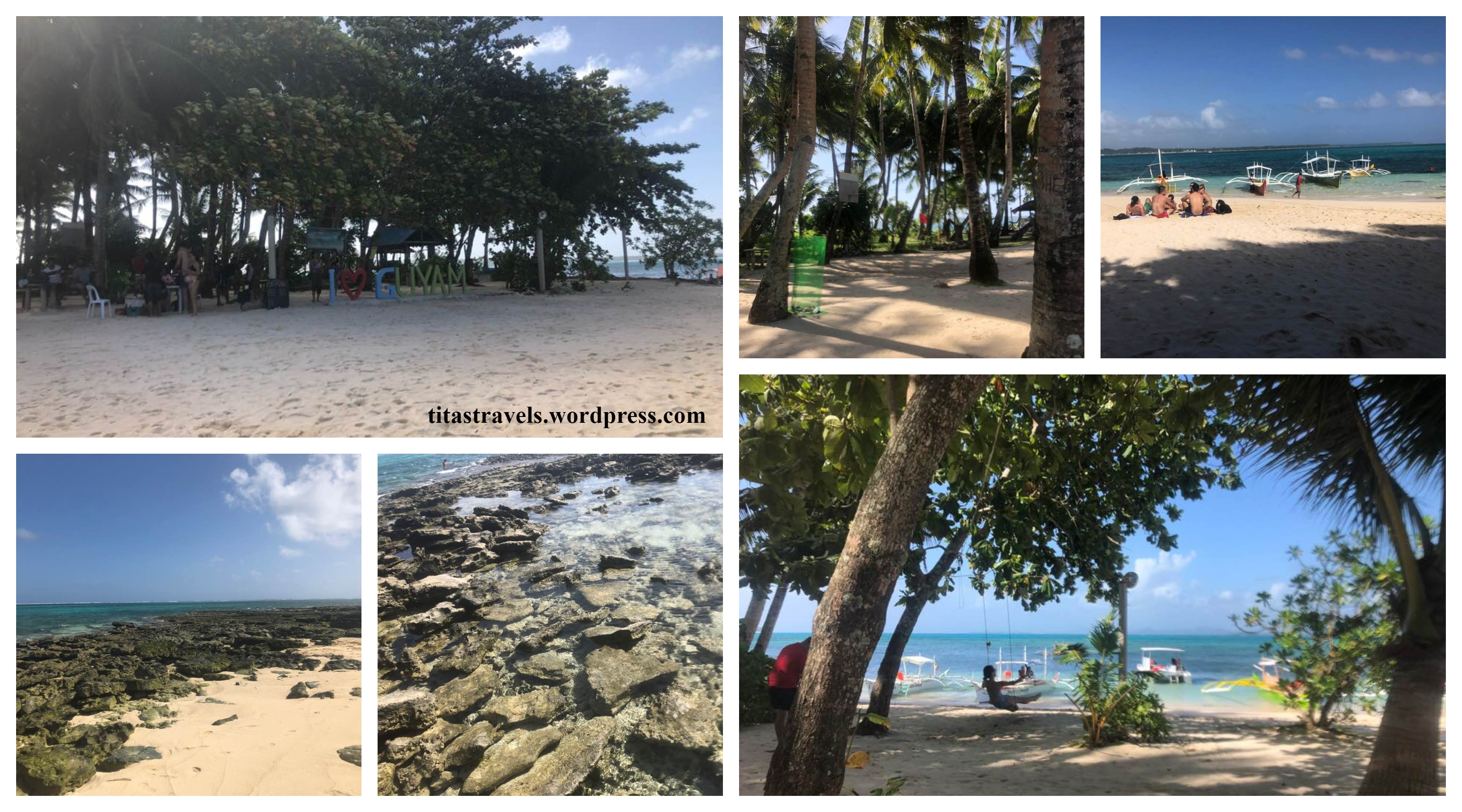 Guyam Island, Siargao, January 2019
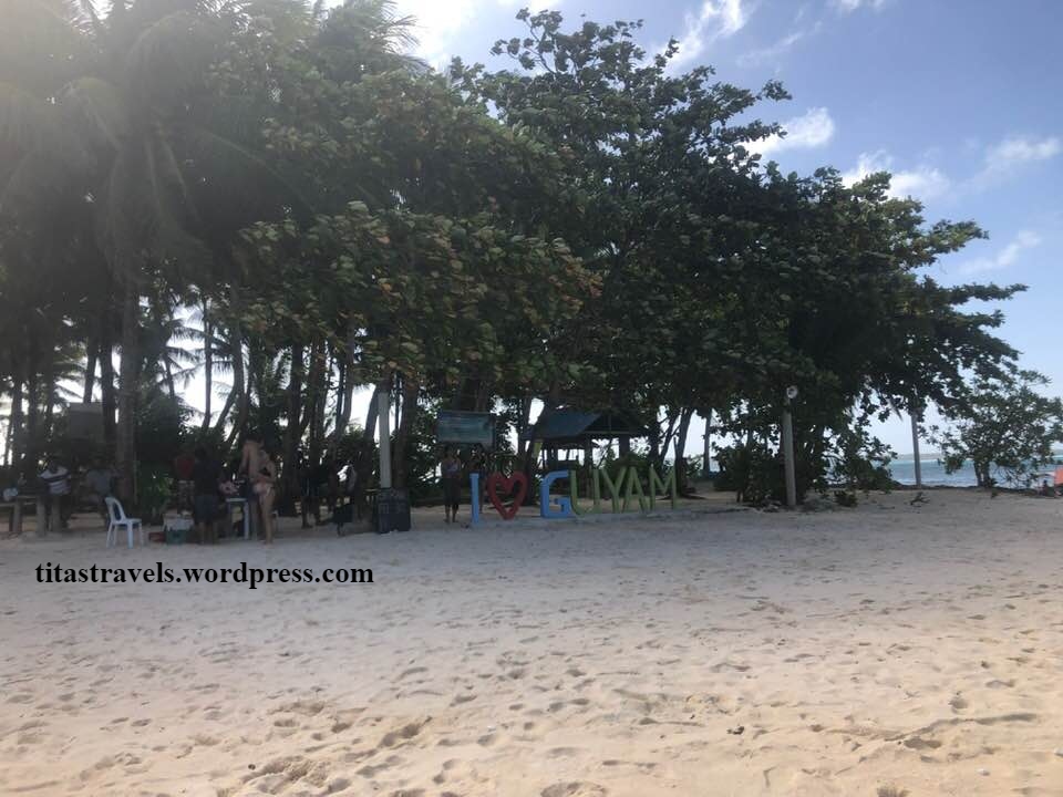
 All the pictures in the collage are my January 2019 pictures, except for the bottom-right which I got from
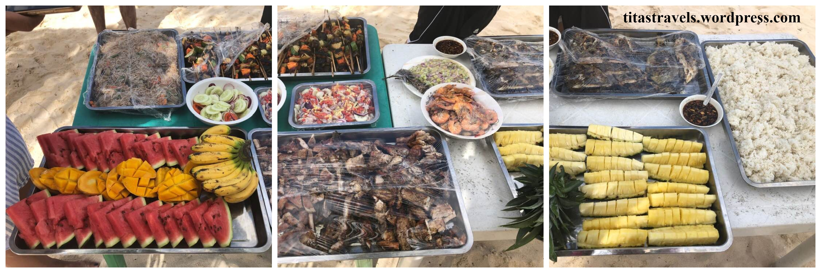
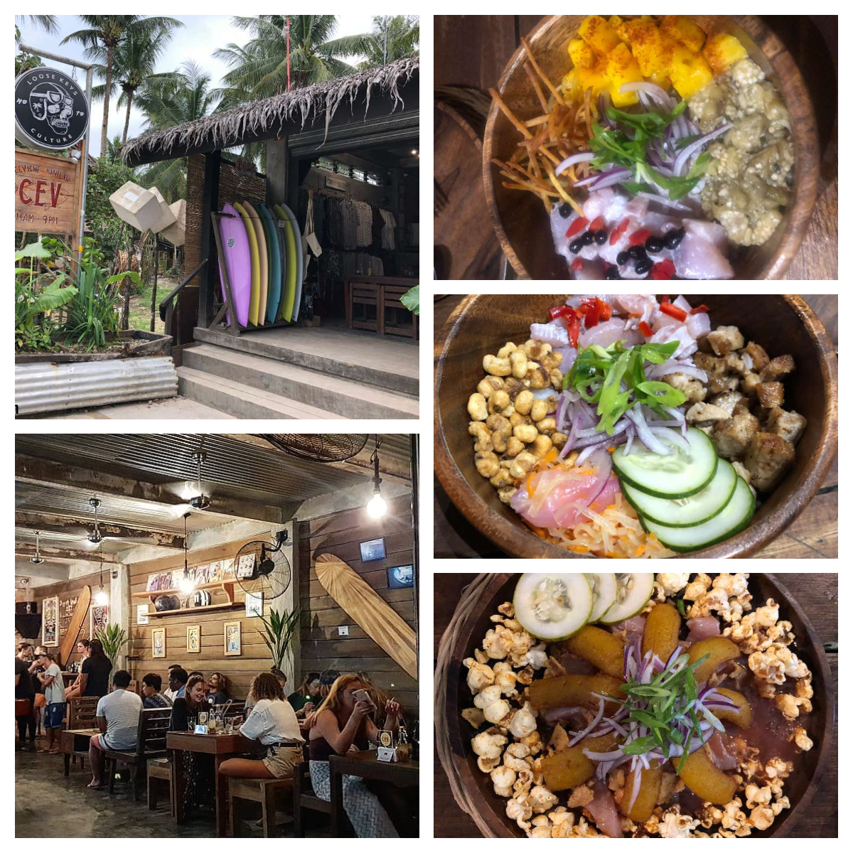
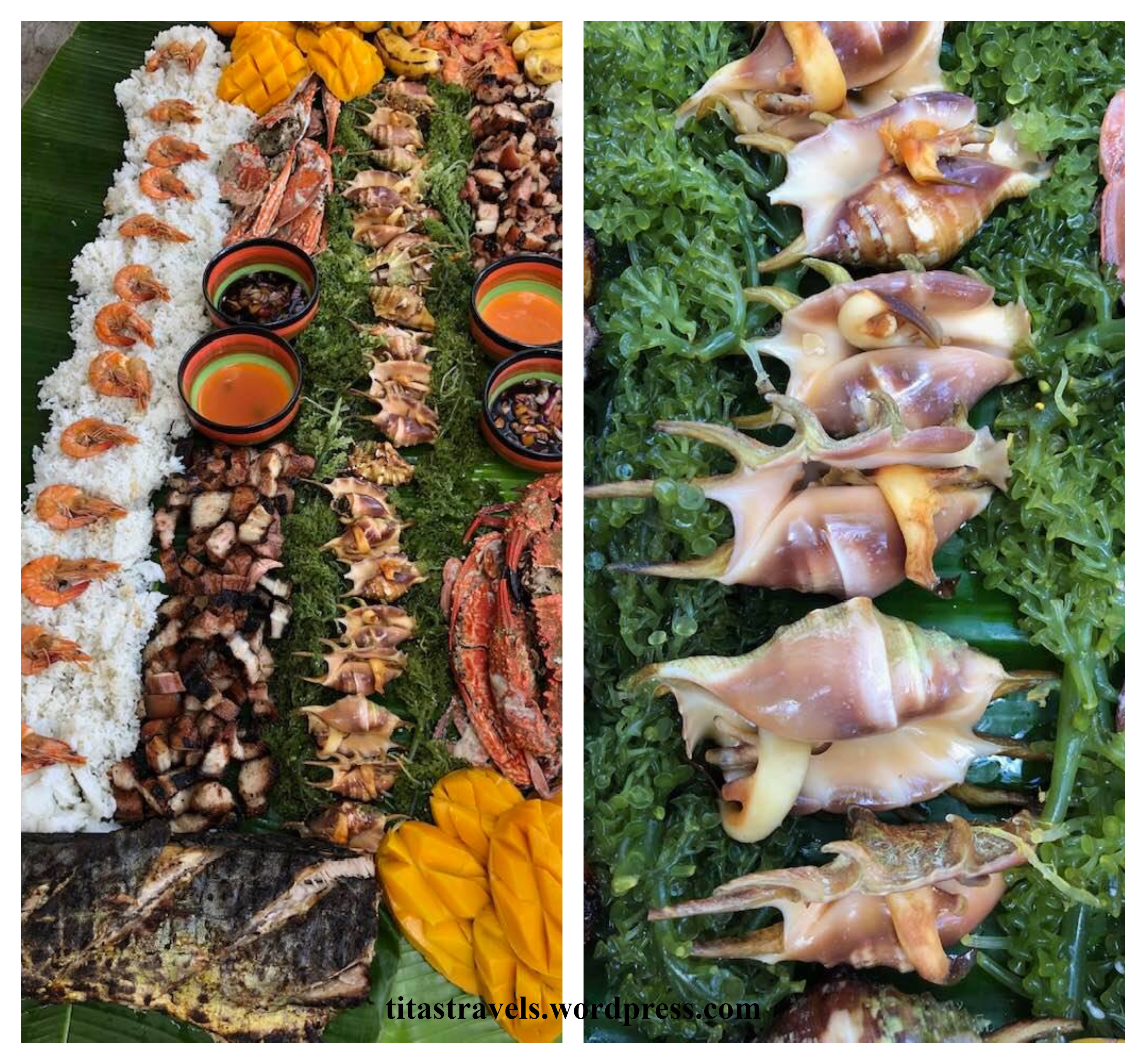 Boodle Fight offers by another tour provider at Daku Island, Siargao. featuring Spider Shell, locally called Saang. Foreigners, know more about boodle fight, read my post
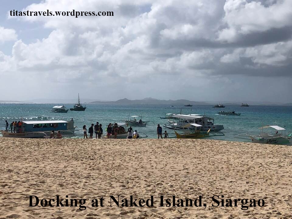

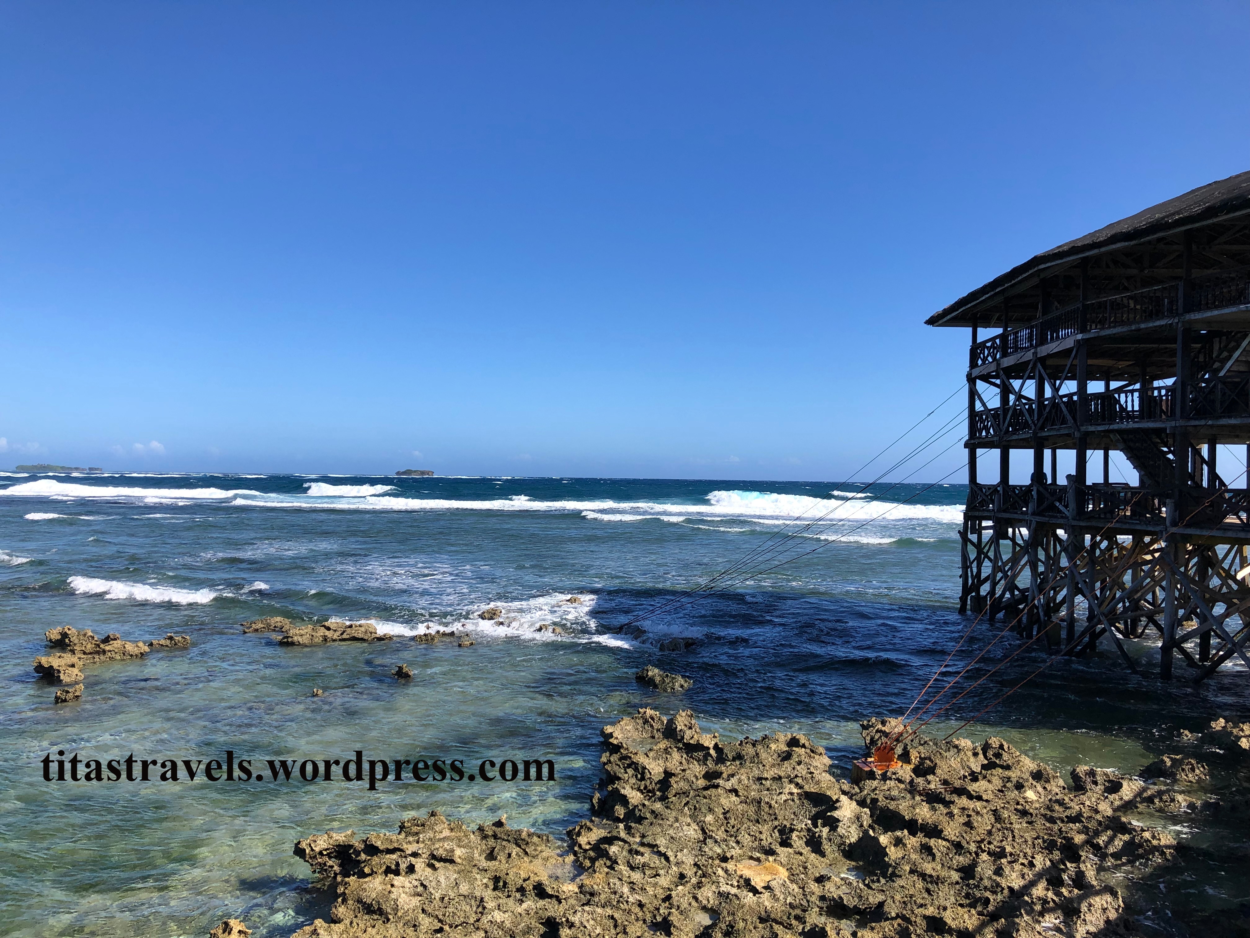
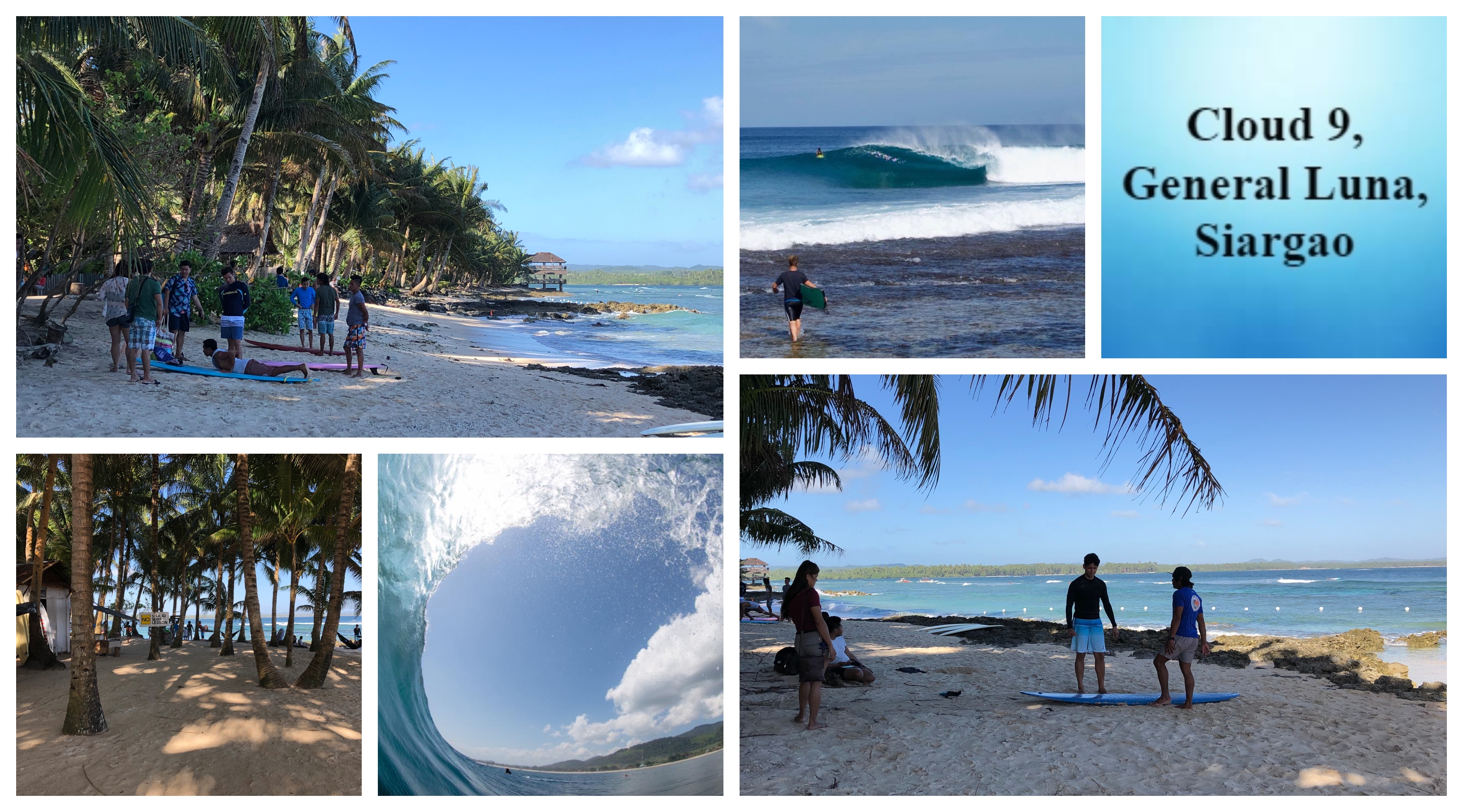 See my post about Cloud 9:
 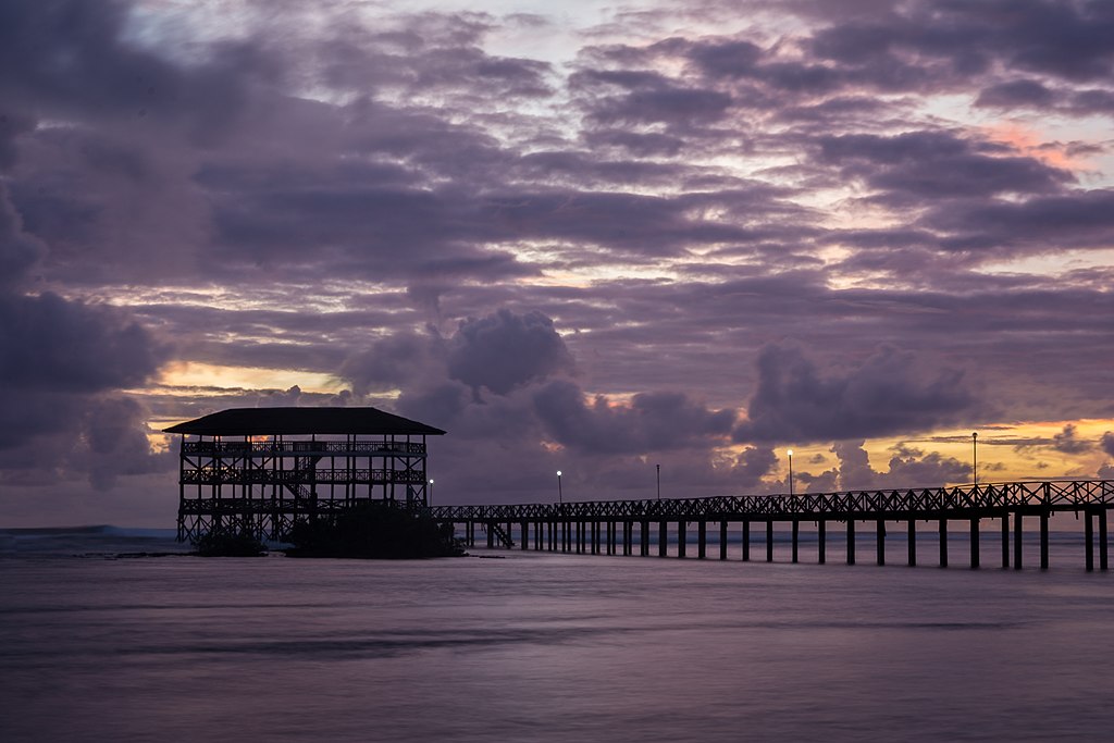 Cloud 9 Boardwalk and Viewing Deck at Sunrise – Photo by JupitReyes, own work, CC BY-SA 4.0, created 16 March 2018,
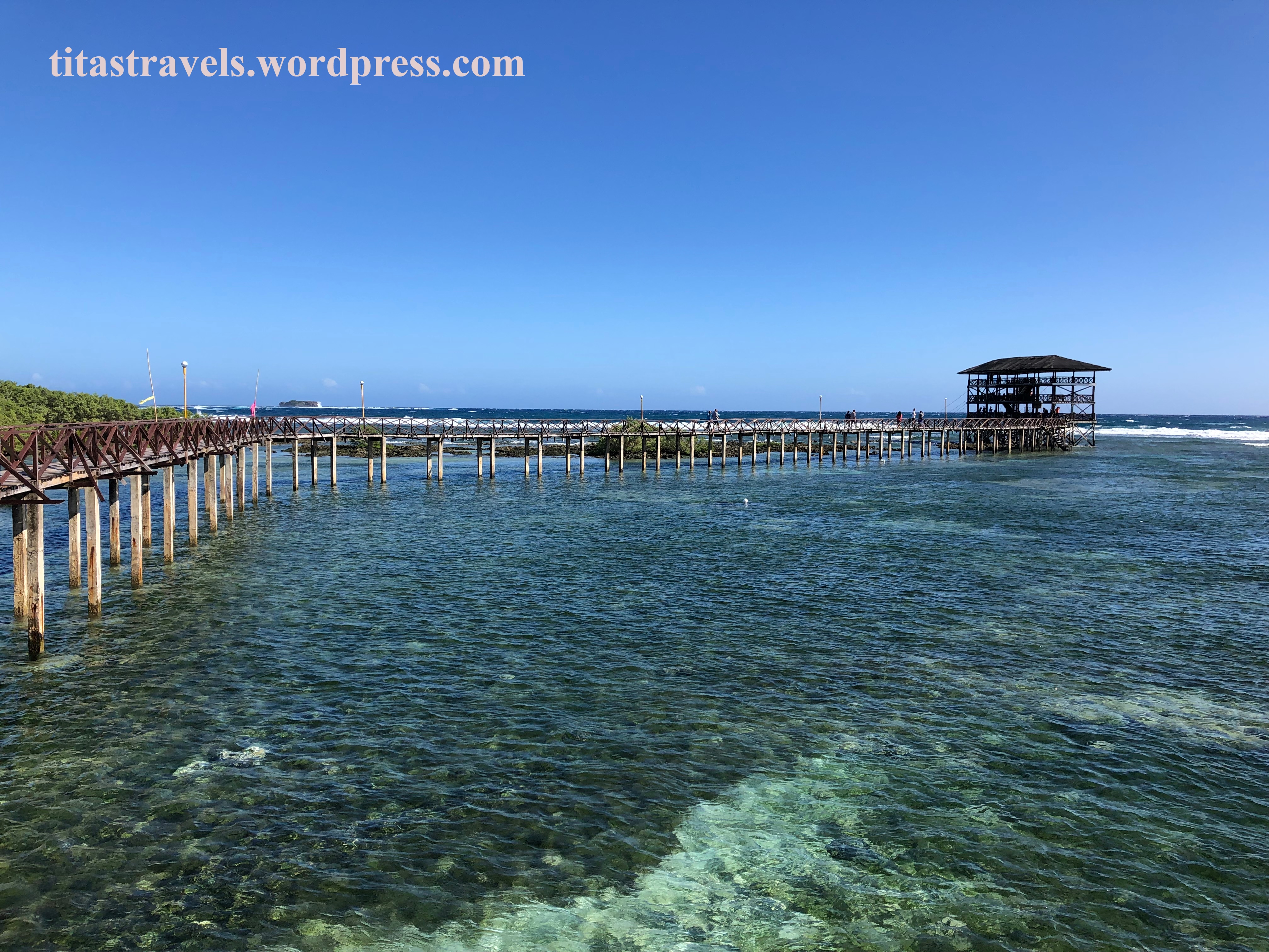
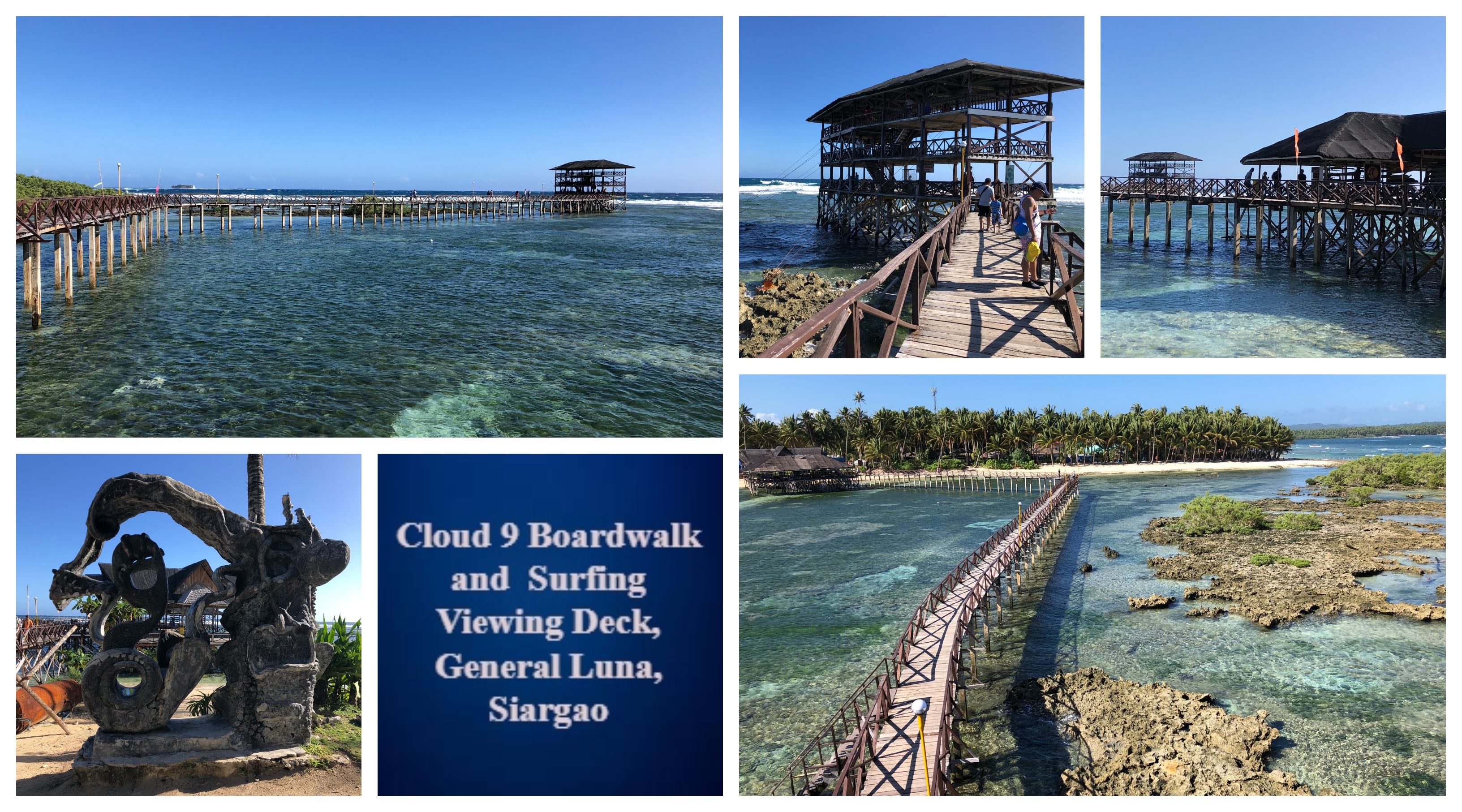
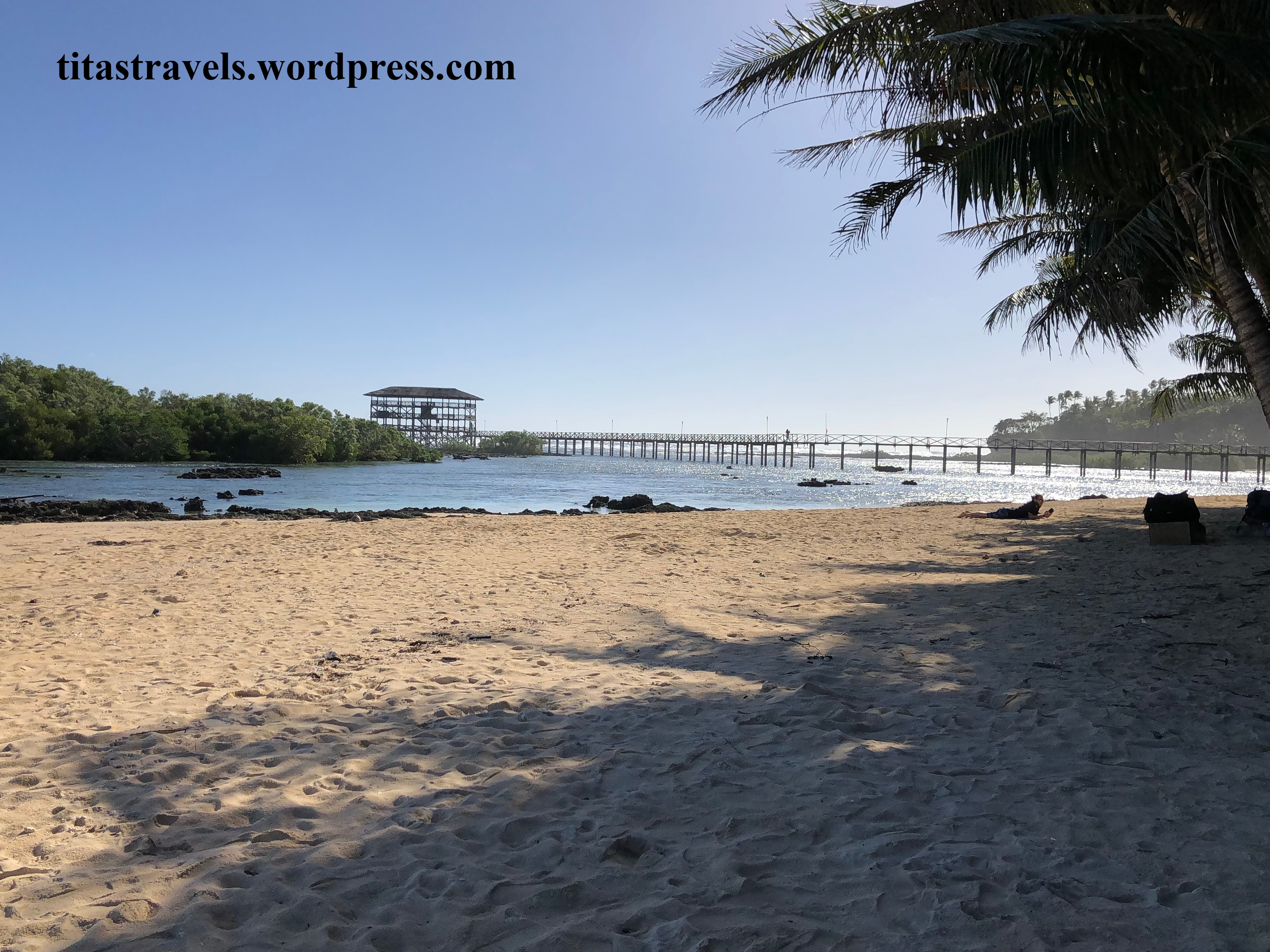 A view from the left part of Cloud 9 where surfing lessons are held. My group walked towards the entry to the boardwalk from this point.
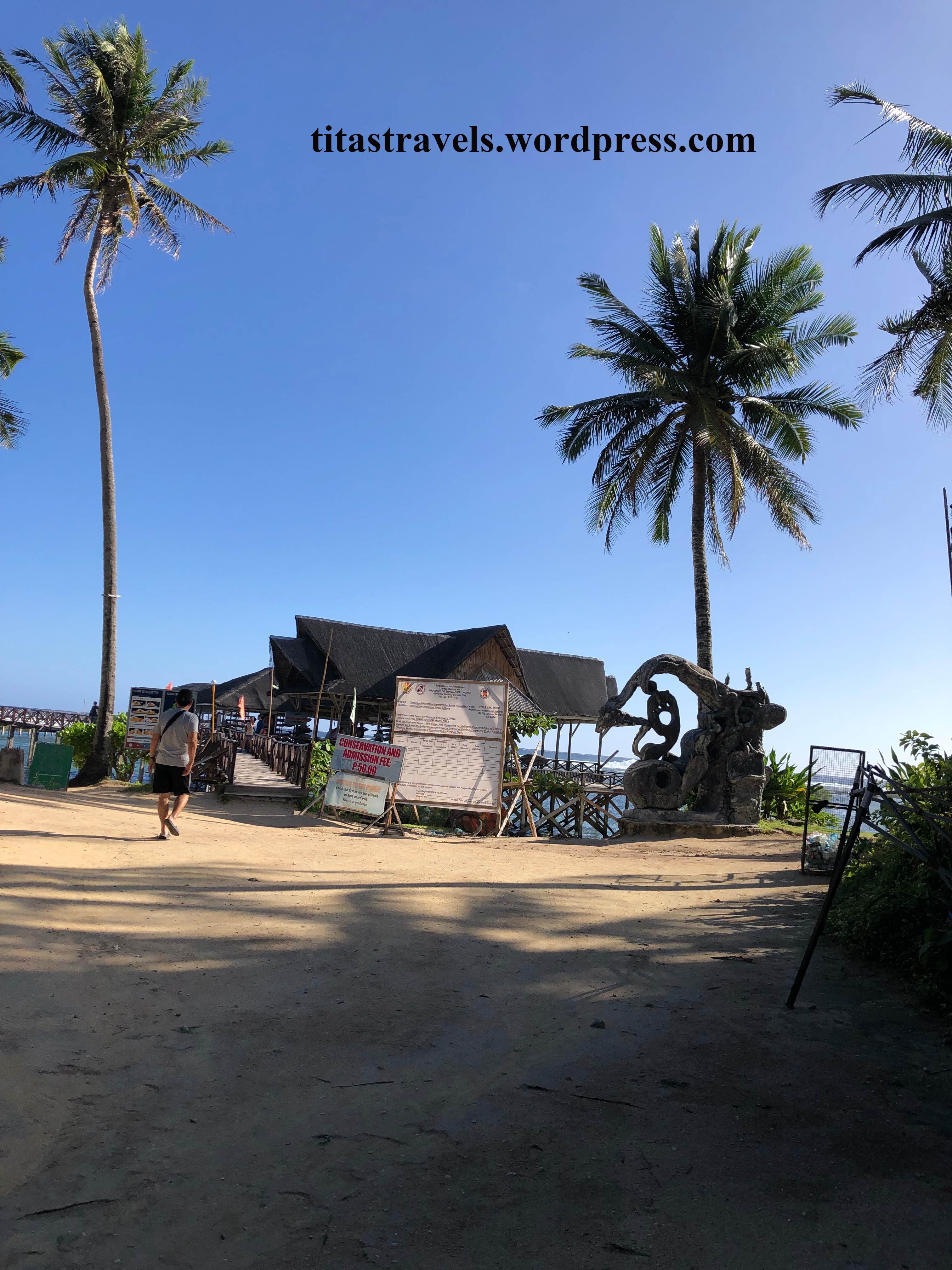 This is the view of the entrance to the boardwalk from the street.
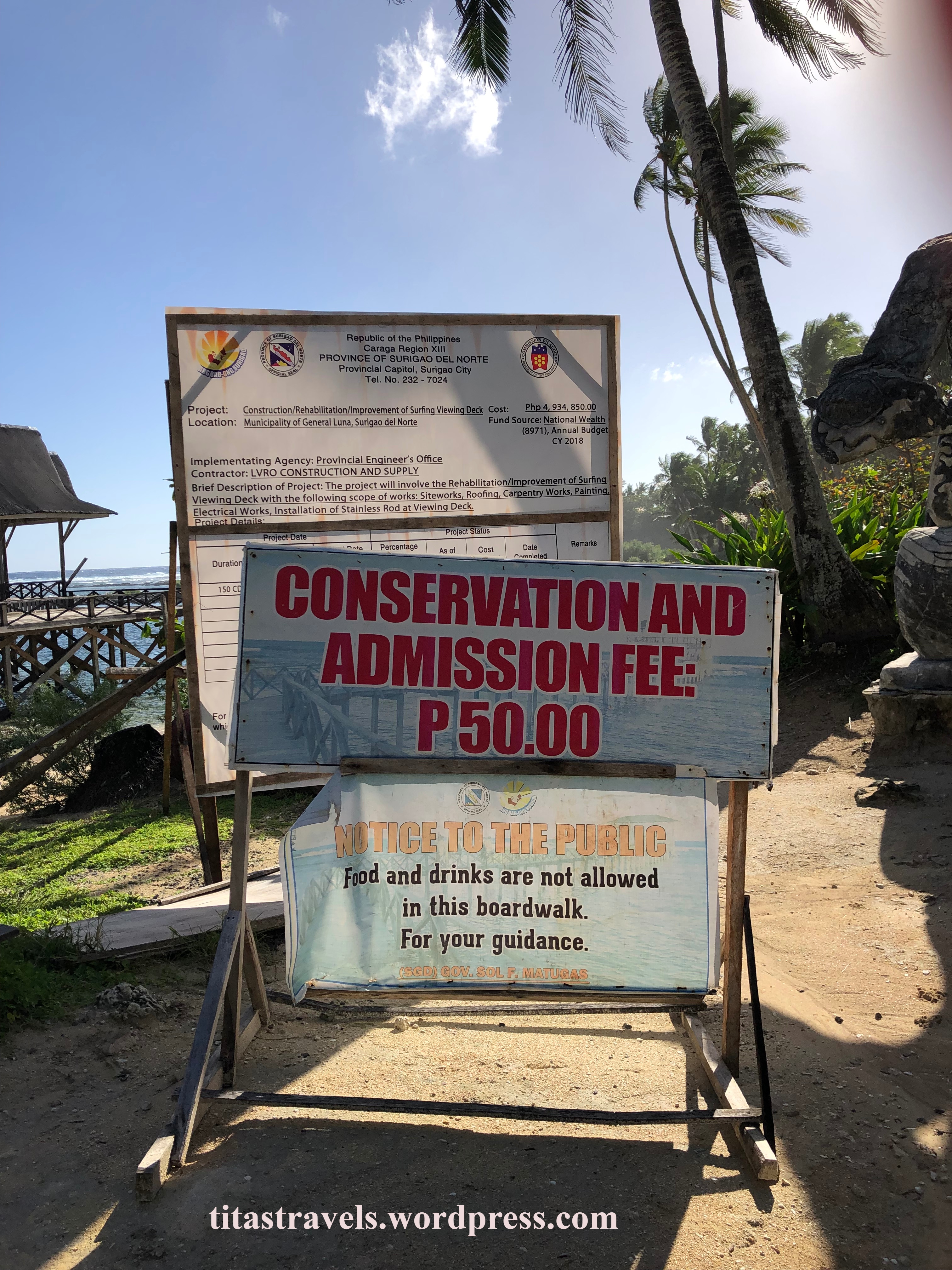 A tourist is required to pay PHP50 as conservation and admission fee. People are advised not to bring food and drinks.
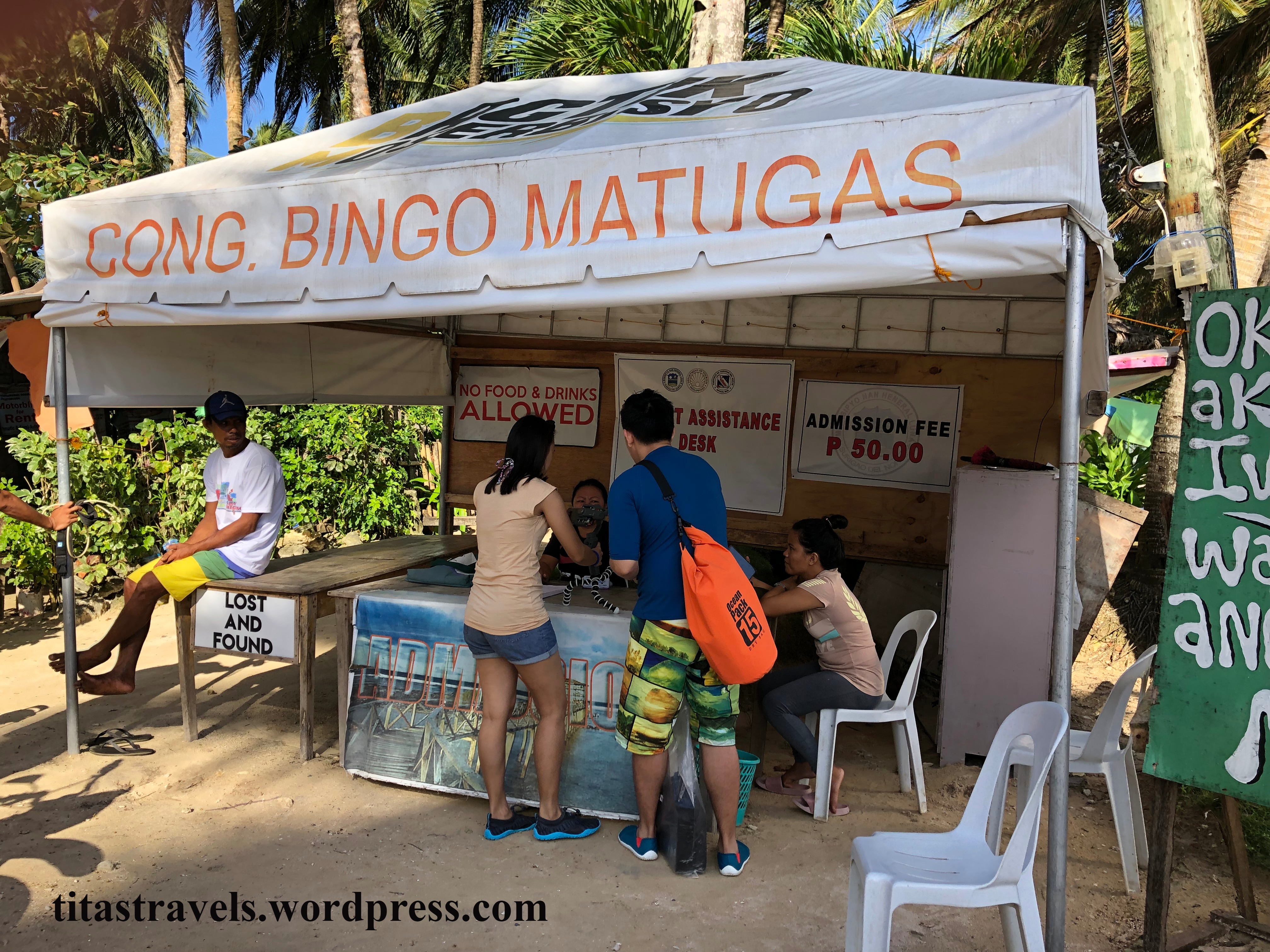 We went to a tent to the left of the entrance and paid the collector.
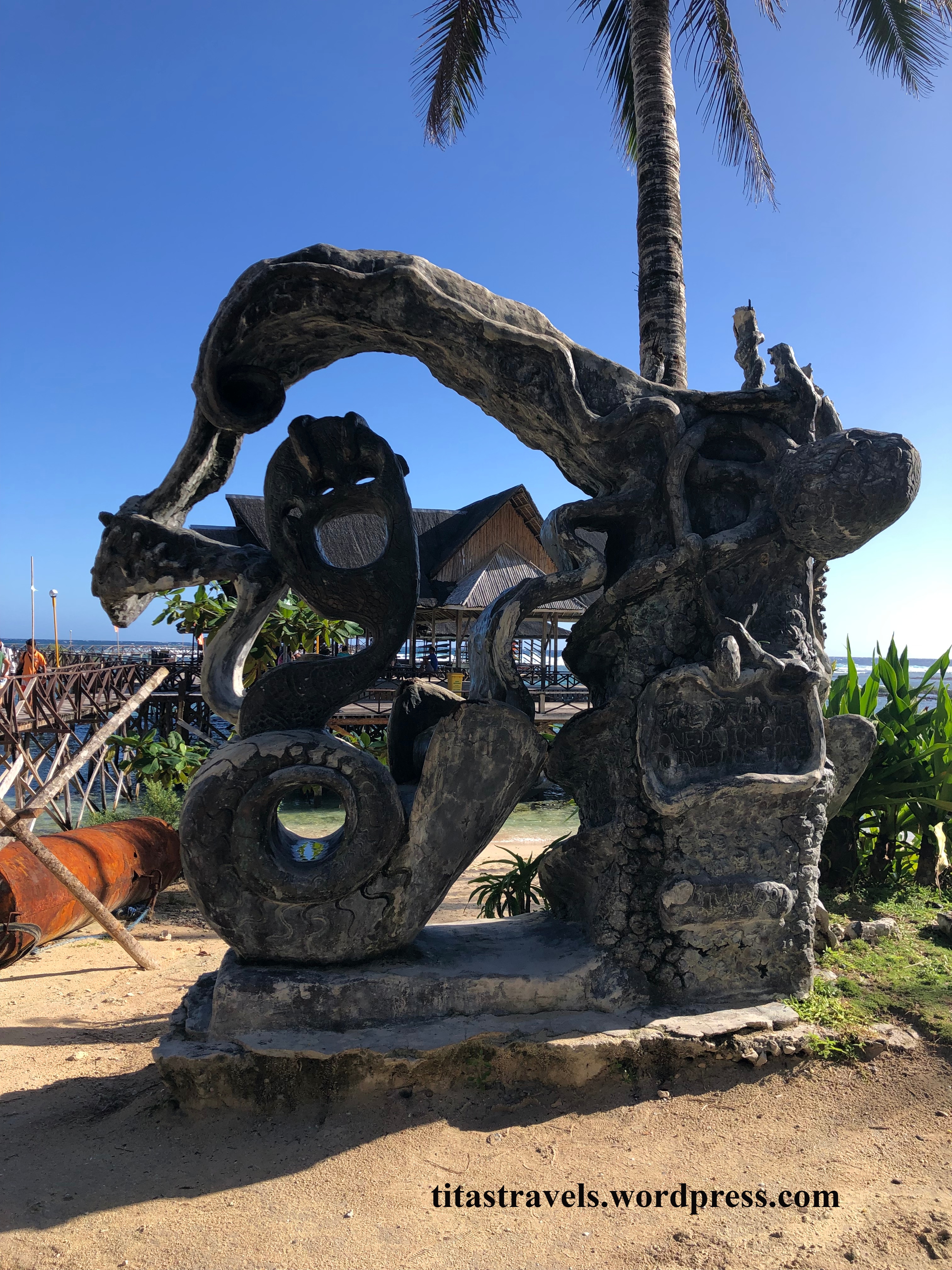 This is the sculpture at the entrance to the boardwalk, dedicated to the Dreamer: “One day, I’m going to tame those waves.”
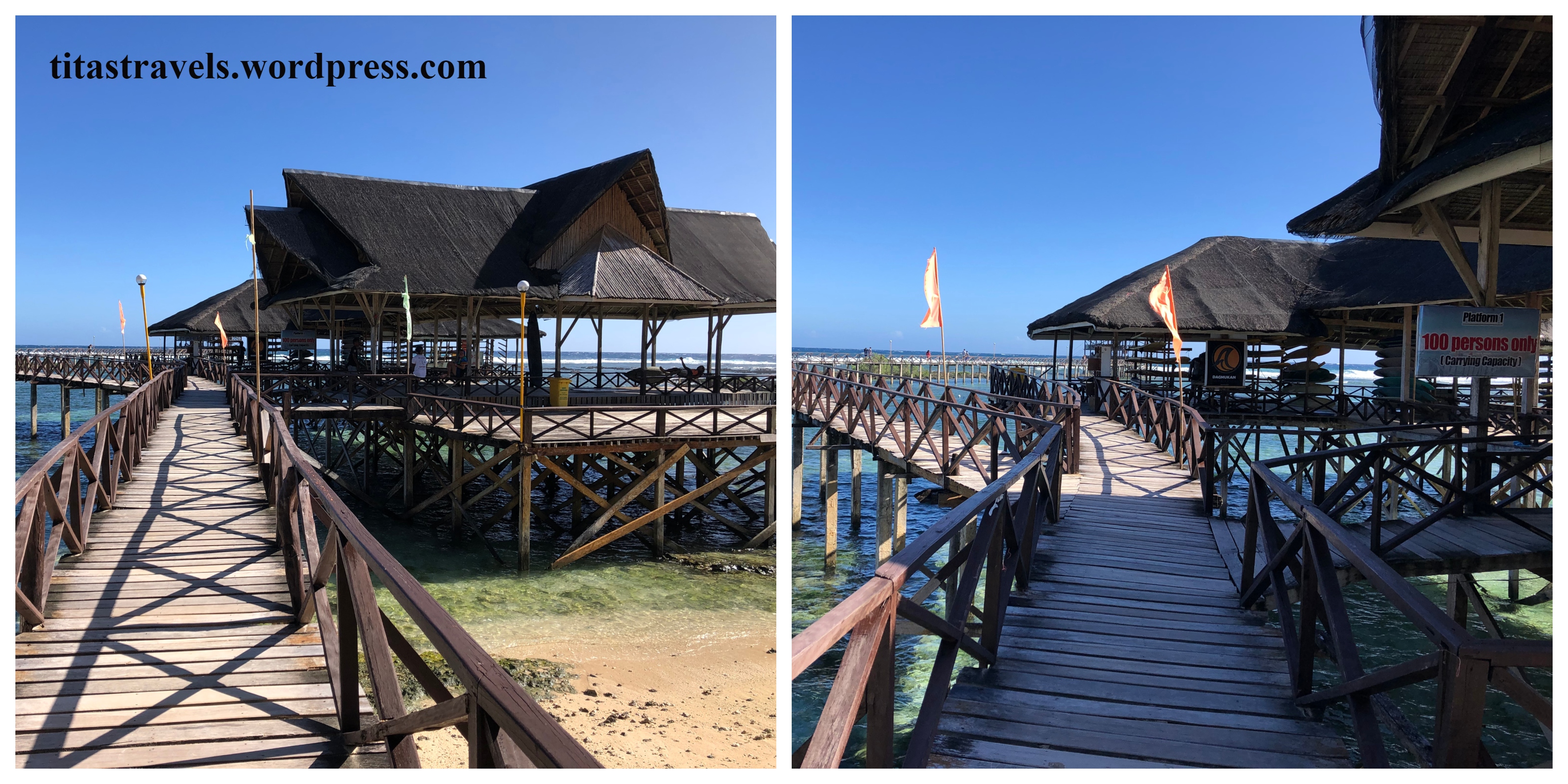
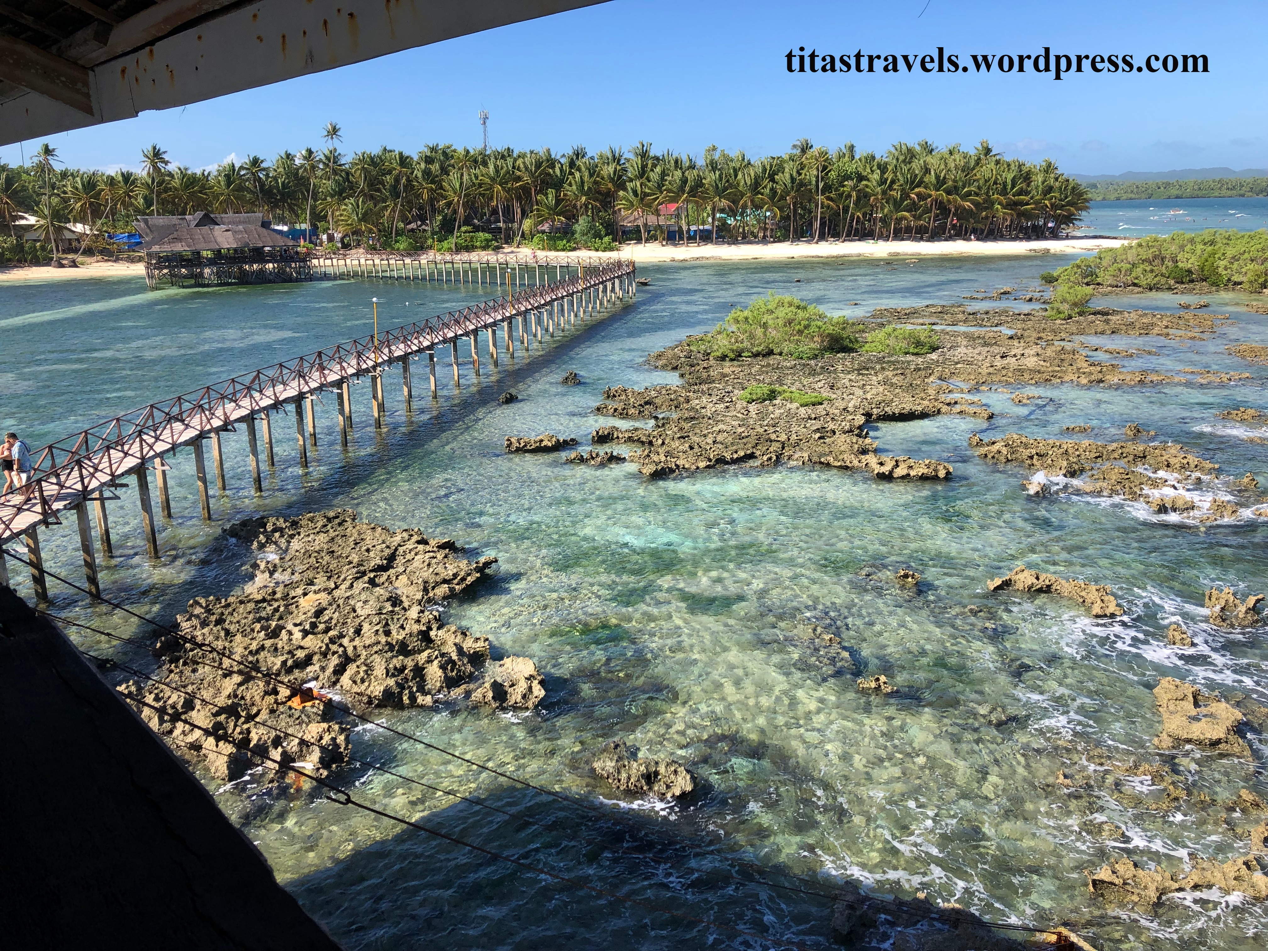
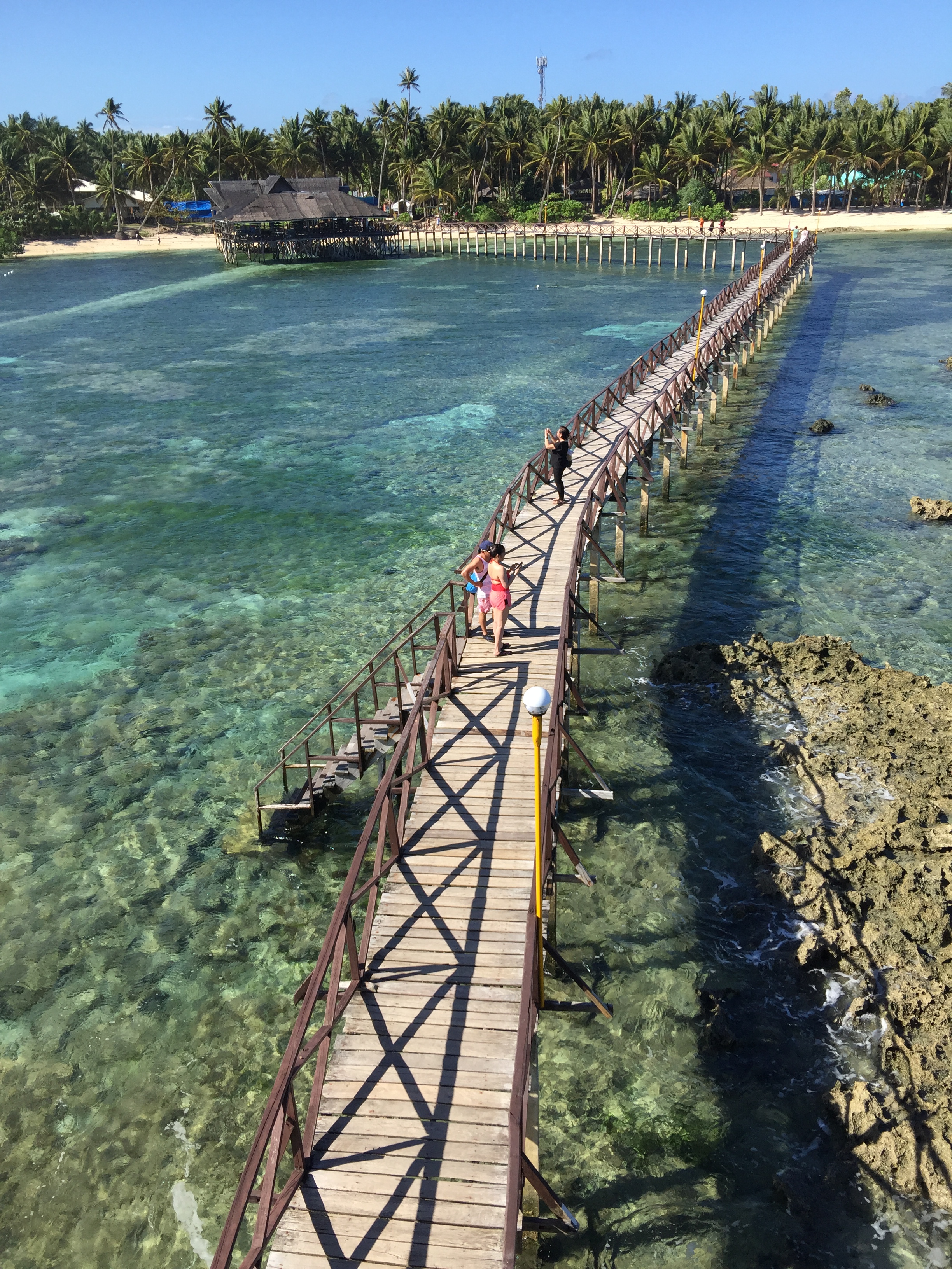 Photo taken by Erie R. Ama, January 8, 2019
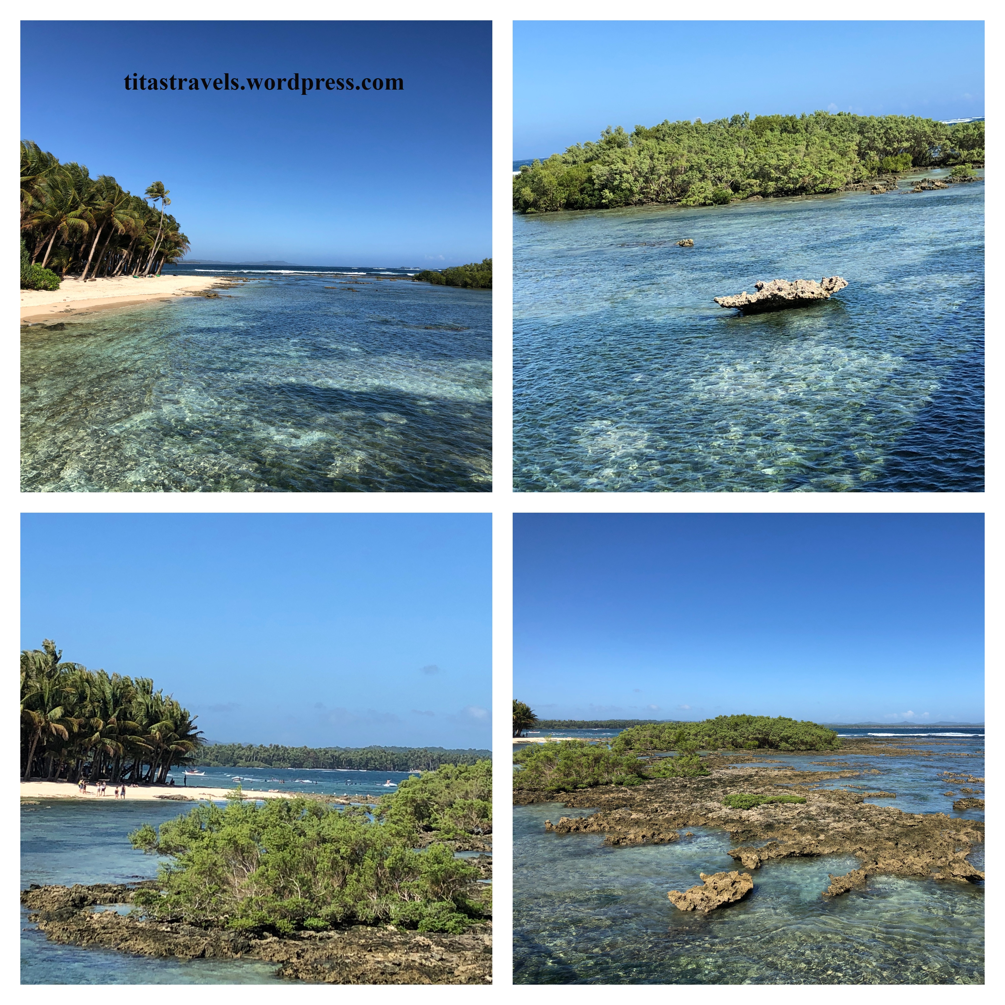
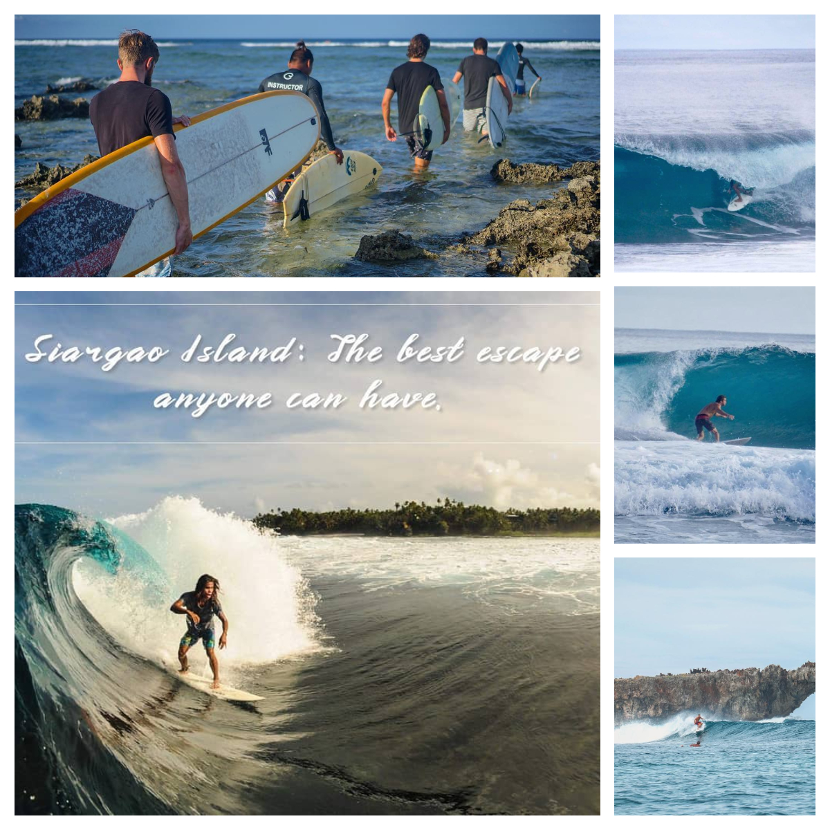
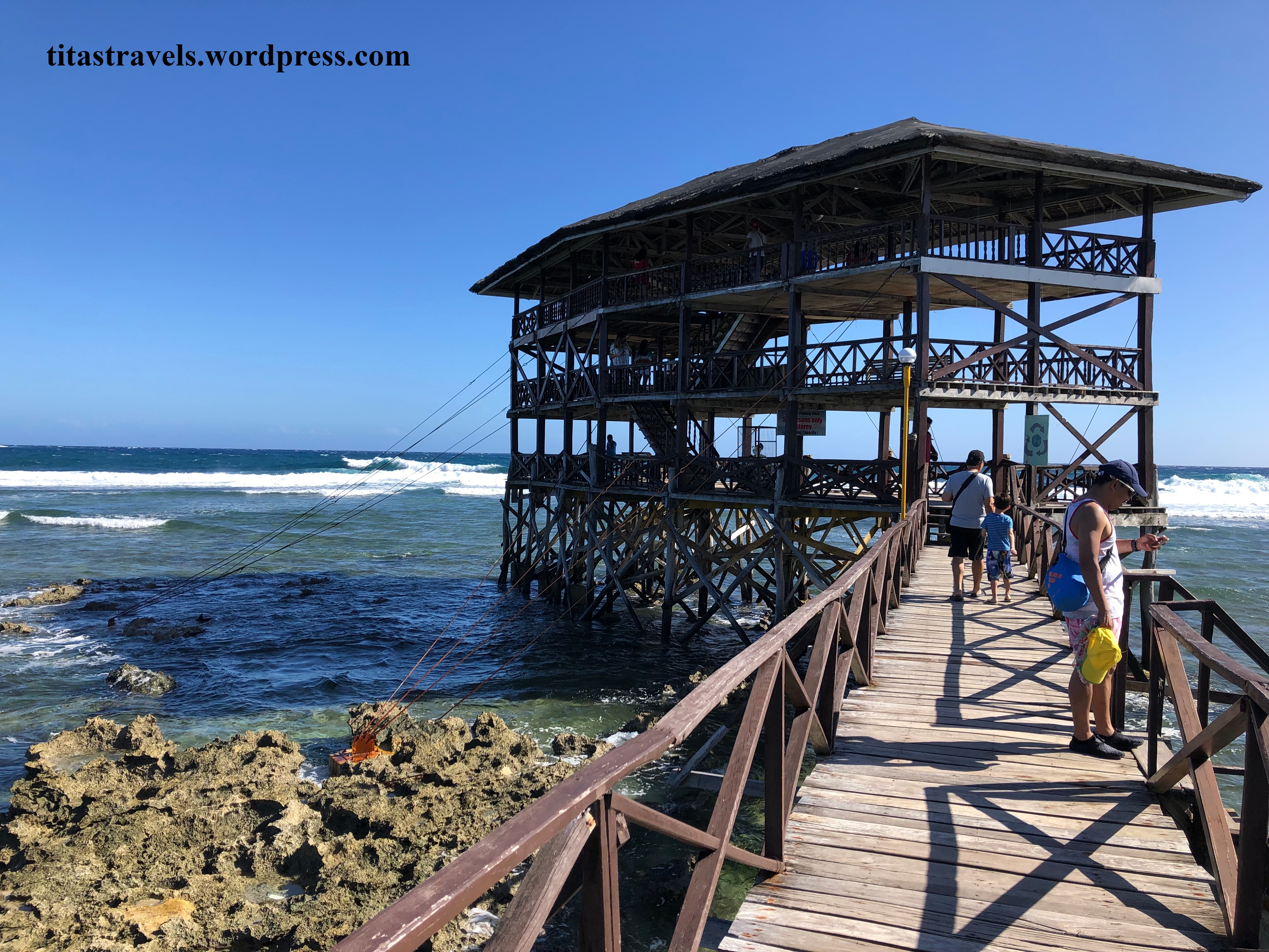 This surfing viewing deck offers a great view of Cloud 93, the awesome seascape, the sound and sight of the spectacular waves, the surfers having a great time, and the refreshing sea breeze! For sure, you want to take lots of Instagrammable photos and videos.