

Dear readers, yes, you better believe it! Camiguin Island has more volcanos than towns! Do you want to know more? Allow Tita S to tell you.
First, let her tell you about some important information regarding this island.
Camiguin is a pearl-shaped island-province in the Bohol Sea, in the Northern Mindanao1 region2 of the Philippines.
Aside from the main island, this province3 also includes a few other surrounding minor islets like:
* White Island, about 5 km (3.1 mi) west of the capital-municipality4 of Mambajao; and,
* Mantigue Island, about 14 km (8.7 mi) south of Mambajao.
It is the second smallest island in the Philippines, in both land area (238 sq.km. or 92 sq.mi.) and population, next to Batanes, an archipelagic province3 in the northernmost part of the country.
The provincial capital is Mambajao, Camiguin’s largest municipality4, both in area and population.
Camiguin is blessed with so many attractions and a special event (which I alphabetically arranged because it is difficult to rank them):
* Ardent Hot Springs – for a relaxing and soothing dip after a long day of exploring the island
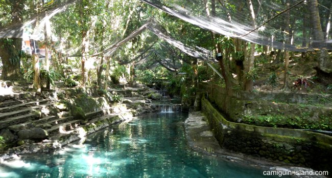
Photo source: https://www.camiguin-island.com/ardent-hot-springs.shtml
* Binangawan Falls – only for diehard hikers because of the challenging trek required for the visit
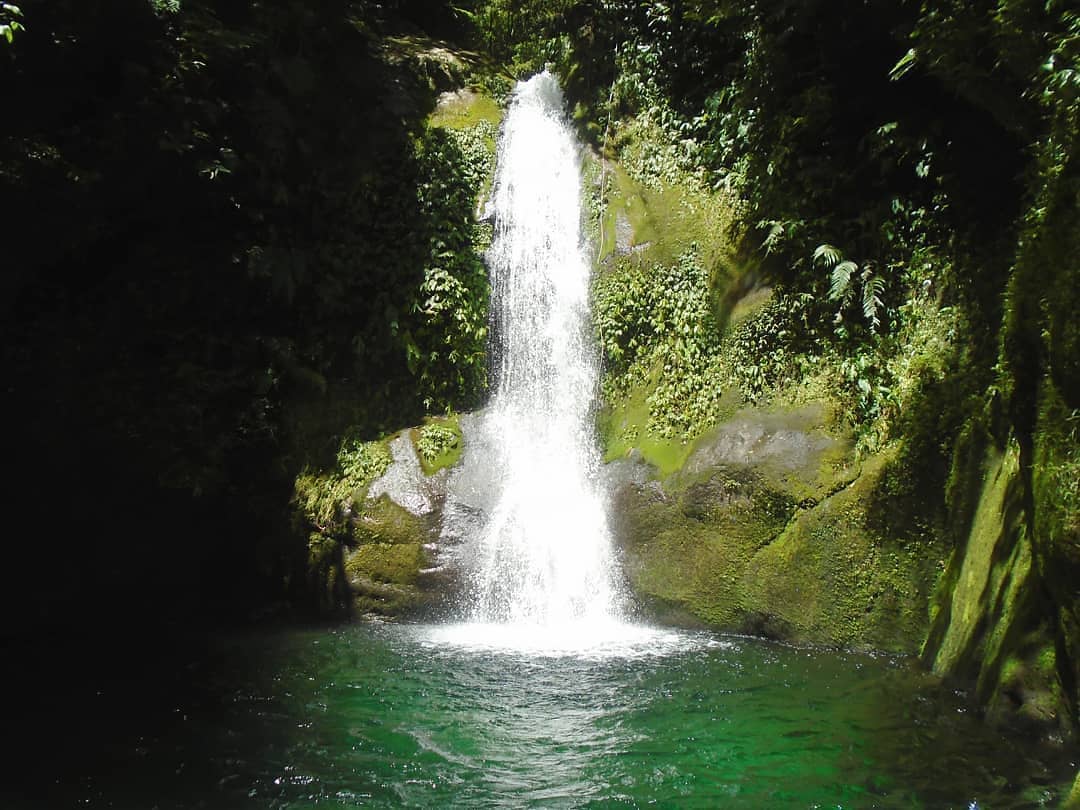
Photo source: https://www.facebook.com/Camiguintourismoffice/photos/2093474984000721
* Bura Soda Water Park – a different swimming experience; the only soda water pool in the Philippines

Photo source: https://www.facebook.com/sodanature/photos/3855744017872720
See my post about this water park: BURA SODA WATER PARK (Catarman, Camiguin, Philippines)
* Guinsiliban Watchtower – a Spanish era watchtower, declared a National Cultural Treasure of the Philippines
* Gui-ob Ruins – this is the Old Bonbon Church Ruins in the town of Catarman
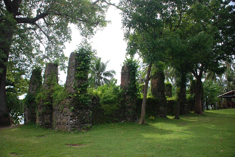
Photo source: Nikond80, own work, CC BY-SA 3.0, created 24 September 2013, https://en.wikipedia.org/wiki/Camiguin#/media/File:Ruin_of_old_church_Bonbon_Catarman_Camiguin_island.jpg
* Katibawasan Falls – a 250-m high waterfalls; the most visited waterfalls in the island
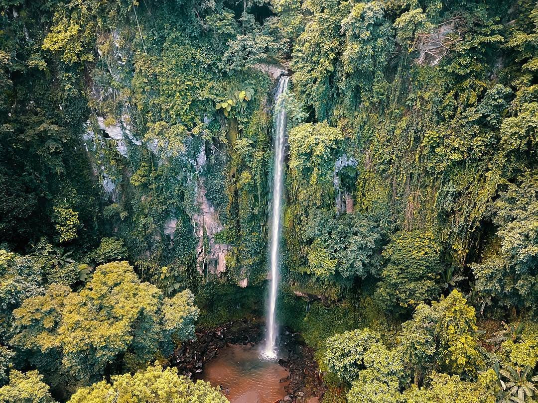
Photo source:
https://www.facebook.com/Camiguintourismoffice/photos/2016019508412936
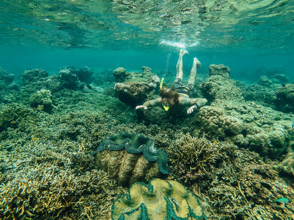
* Kibila White Beach – the site of the giant clam sanctuary in the town of Guinsiliban
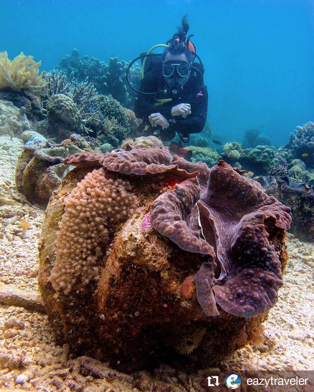
Eight of the twelve giant clam species in the Philippines can be found here, including Tridacna gigas, which can grow up to 1.2 meters across and weigh up to 200 kg, making it the largest living bivalve mollusk! Kudos to the community for taking care of this precious living thing! – Photo source: https://www.facebook.com/Camiguintourismoffice/photos/2810716252276587
* Lanzones – considered the sweetest kind you can find in the Philippines, attributed to the fertile volcanic soil of the island from trees which are 10-30 years old; this seasonal fruit is harvested in Camiguin from March-April, but visit this island on October to see their festival (below) too.
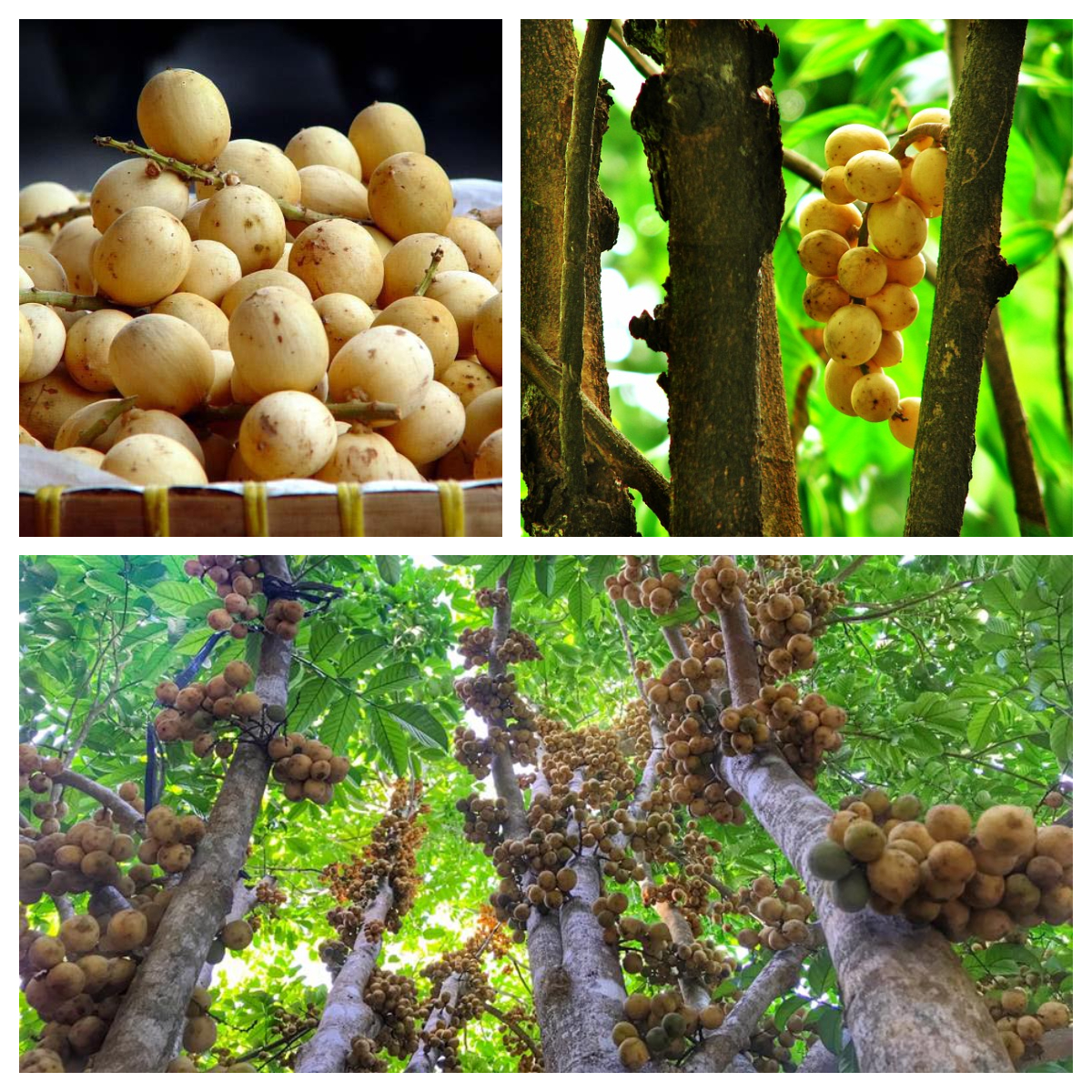
The sweetest lanzones – Sources of photos in photo-collage (top-bottom, l-r): https://www.facebook.com/Camiguintourismoffice/photos/a.162865887061650/526242177390684, https://www.facebook.com/Camiguintourismoffice/photos/a.424415580906678/526243610723874 and https://www.facebook.com/Camiguintourismoffice/photos/2375672632447620
See my related post about this fruit: Savoring Pinoy Delights: THE LUSCIOUS LANZONES
* Lanzones Festival – held annually every third weekend of October
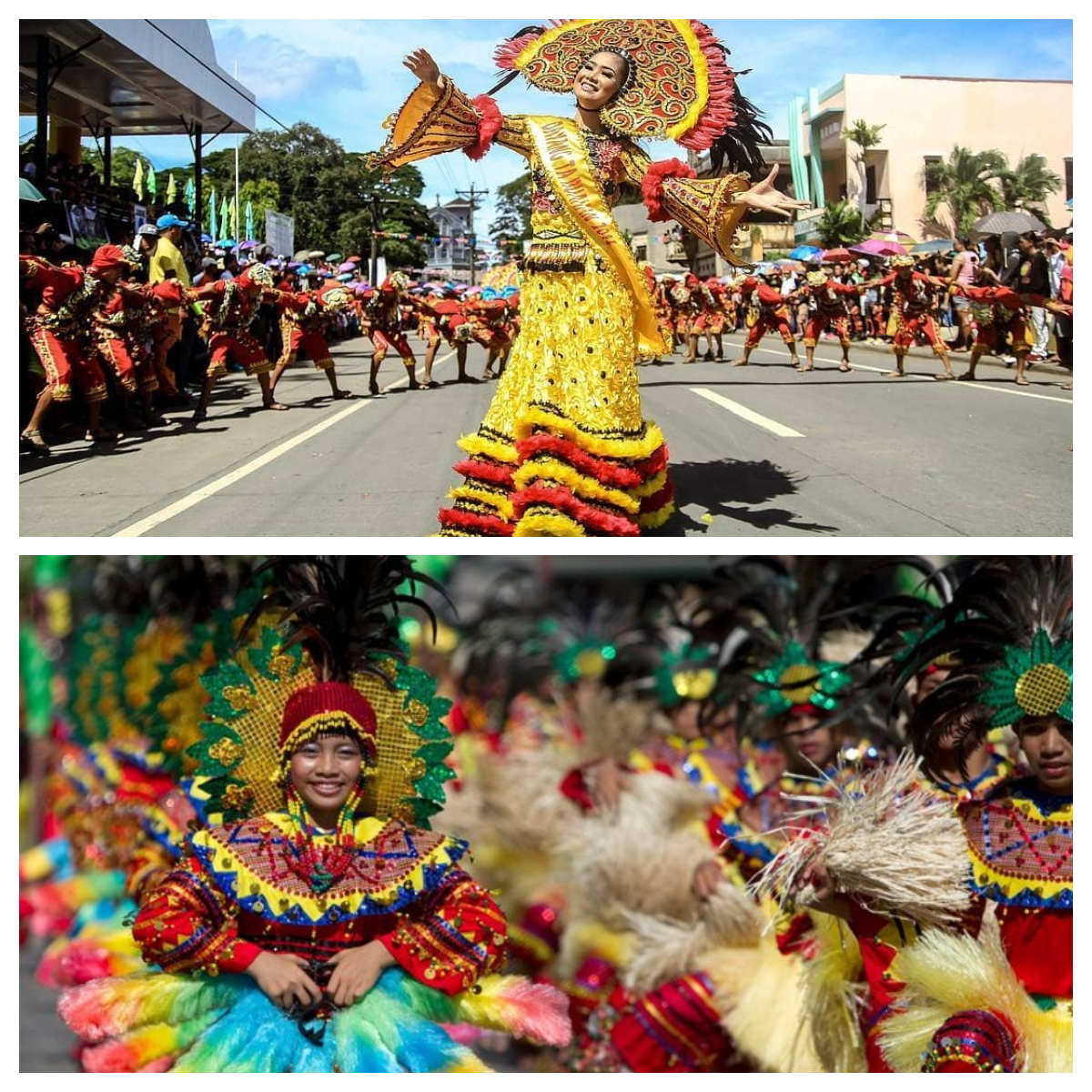
Sources of photos (top-bottom): https://www.facebook.com/Camiguintourismoffice/photos/2310944688920415 and https://www.facebook.com/Camiguintourismoffice/photos/380806731934230
* Mantigue Island – a protected marine sanctuary; for snorkeling and diving
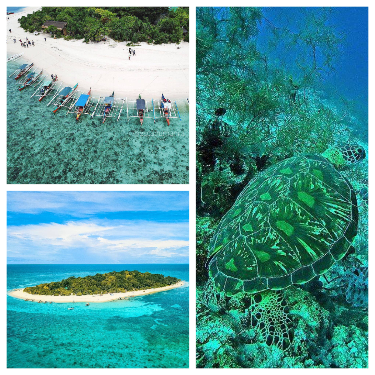
Sources of photos (tom-bottom, l-r): Mantigue Island’s shore – https://www.facebook.com/Camiguintourismoffice/photos/1891182004230021, Turtle Point – https://www.facebook.com/Camiguintourismoffice/photos/1904849792863242 and The Island from Afar – https://www.facebook.com/Camiguintourismoffice/photos/1891182004230021
* Mount Hibok-Hibok – for hiking and mountaineering (see below)
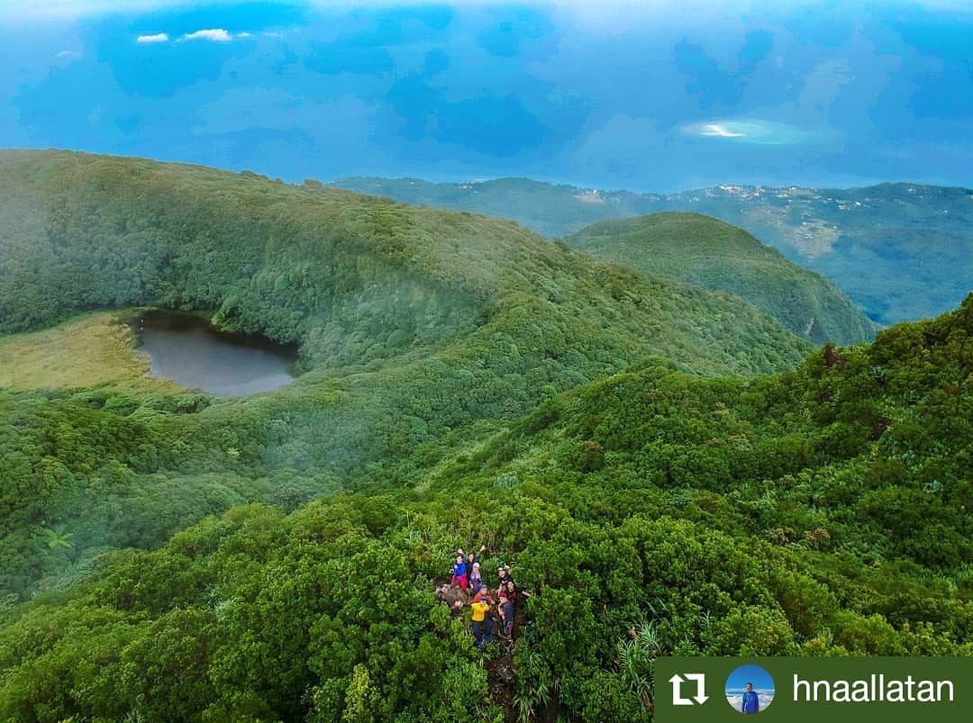
It takes 4-5 hrs. to reach the summit – Photo source: https://www.facebook.com/Camiguintourismoffice/photos/2607989339215947
* San Nicolas de Tolentino Parish Church – this church is located in the capital town of Mambajao, founded in 1916, and celebrates the feast of Saint Nicholas of Tolentino6 every September 10.
* Santo Niño Cold Spring – a place to chill after a long day in the island
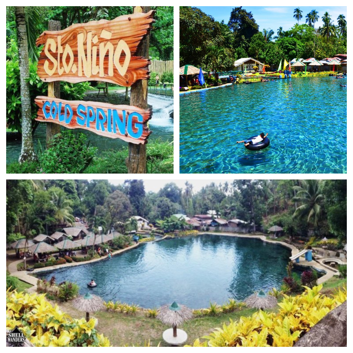
Source of photos: https://catarmancamiguin.gov.ph/tourism/sights-to-see/
* Sunken Cemetery – the submerged cemetery in the coastal area of Catarman due to the 1871 eruption of Mount Vulcan (more details about this volcano below)
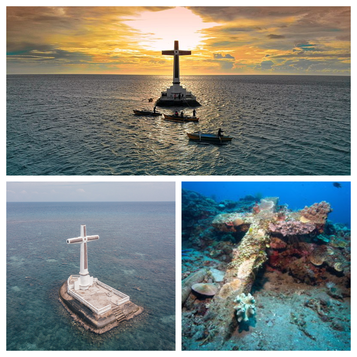
Sources of photos in photo-collage: Allan Jay Quesada, own work, CC BY-SA 4.0, created 8 June 2019, https://en.wikipedia.org/wiki/Camiguin#/media/File:ALLAN_JAY_QUESADA_-_CAMIGUIN_01_DJI_0611.jpg (top) and https://catarmancamiguin.gov.ph/tourism/sights-to-see/ (bottom)
You can see these giant clams at this snorkel spot of the Sunken Cemetery of Camiguin. You can also visit the giant clam sanctuary on the eastern part of the island at Kibila White Beach. – Photo source: https://catarmancamiguin.gov.ph/tourism/sights-to-see/
* Taguines Lagoon – a man-made lagoon for recreation and aquaculture experience
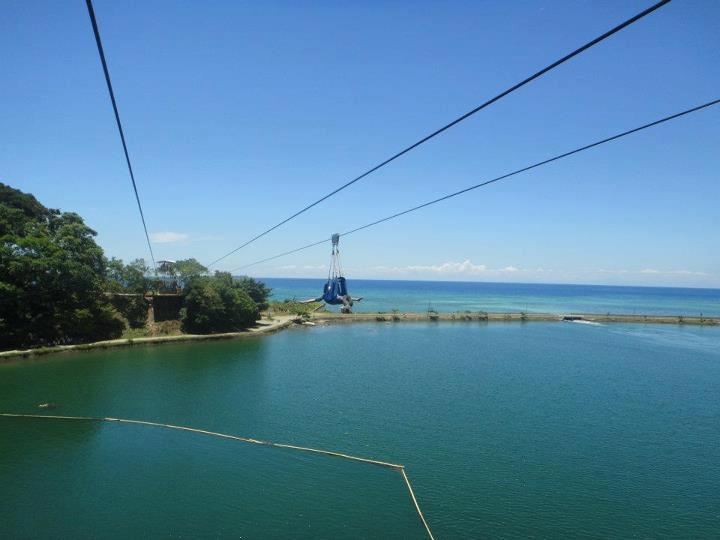
Zip line – Photo source: https://www.facebook.com/Camiguintourismoffice/photos/449184525096450
* The Walkway – see Mount Vulcan below
* Tuasan Falls – a 25-m high waterfalls for nature lovers
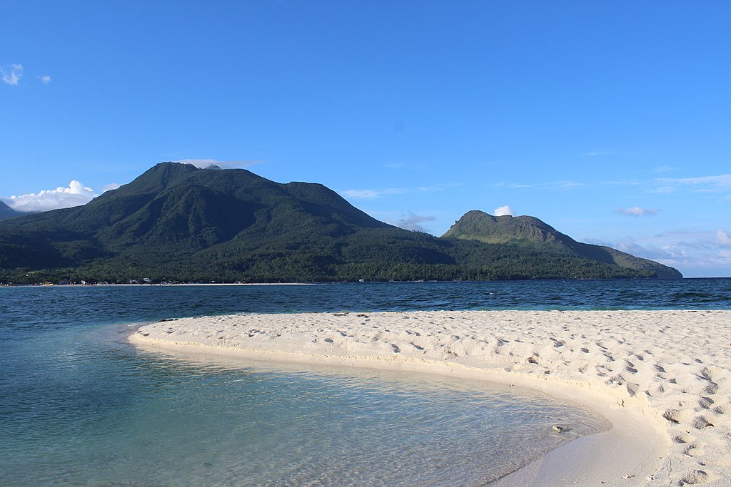
* White Island-Sand bar – for swimming and snorkeling, located off the northern coast of Mambajao
Photo source: https://www.facebook.com/Camiguintourismoffice/photos/4615785558436305
And if all the above are not enough, Tita S will tell you why this island is extra special, and this is for the record!
This province3 has 5 municipalities4 (or towns), with a total of 58 barangays5. The municipalities are: Catarman, Guinsiliban, Mahinog, Sagay, and Mambajao, its capital.
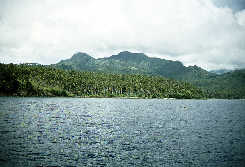
Camiguin is called “The Island Born of Fire” because it has 10 volcanos, two of which are historically active.
There were only 7 known volcanos in Camiguin before the 1980s but since then, volcanologists added 3 more volcanos in this island, and believe there could be more! Amazing!
Have you noticed something by now? Within its land area of 238 sq.km. (92 sq.mi.), there are 5 municipalities4 (towns) and 10 volcanos! So there you have it: this province has more volcanos than towns! In fact, it has the largest concentration of volcanos per sq. km. in the Philippines, and perhaps, the world.
Now, let me tell you the names of Camiguin’s ten volcanos with brief descriptions:
* Mount Butay
It is located between the towns of Guinsiliban and Mahinog, north of Mount Guinsiliban, and has an elevation of 679 m (2,228 ft). It is also called Mount Uhay.
Mount Butay – Photo source: Briarfallen, own work, CC BY-SA 3.0, created 26 October 1998, https://en.wikipedia.org/wiki/Camiguin#/media/File:Mount_Butay.jpg
* Mount Carling/Karling
It has an elevation of 800 m (2,624.67 ft).
* Mount Guinsiliban
It is located in the town of Guinsiliban, in the southernmost part of Camiguin, and has an elevation of 571 m (1,872 ft).
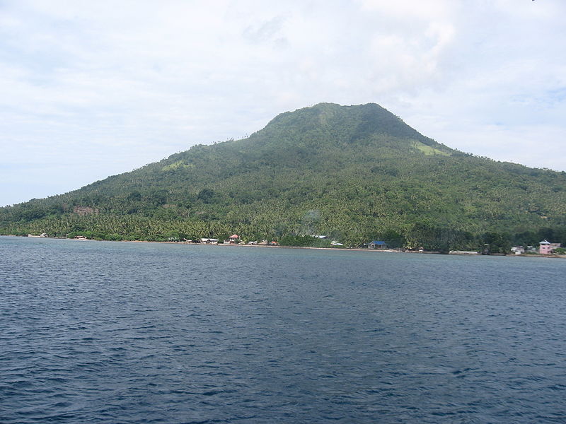
Mount Guinsiliban – Photo source: kLEOMARIO, own work, CC BY-SA 3.0, created 24 August 2006, https://en.wikipedia.org/wiki/Camiguin#/media/File:Mount_Guinsiliban_on_Camiguin_Island.jpg
* Mount Hibok-Hibok
It is also called Catarman Volcano. It is an active stratovolcano and dome complex at the northwestern end of the island. It has an elevation of 1,332 m (4,370 ft). It has 6 hot springs: Ardent Spring, Bugong, Kiyab, Naasag, Tagdo, and Tangob. It has 3 craters: Kanangkaan Crater, the site of the 1948 eruption; Itum Crater, the site of the 1949 eruption; and Ilihan Crater, the site of the 1950 eruption. It last erupted in July 1953.
Mount Hibok-Hibok as seen from White Island – Photo source: Wolfgang Hagele, own work, CC BY-SA 4.0, created 3 June 2017, https://en.wikipedia.org/wiki/Camiguin#/media/File:Hibok_Hibok_volcano_and_Camiguin_volcano.jpg
It is a favorite hiking destination of local mountaineers. A permit from the Department of Natural Resources (DENR) office in Mambajao is required. It takes about 3-5 hours to reach the summit from the usual jump-off point in Ardent Hot Springs in Mambajao.
* Mount Ilihan
The crater of this volcano was the site of the 1950 eruption. I am not a volcanologist but it seems that this volcano was an offshoot of nearby Mount Hibok-Hibok, or volcanogists in the 1950s have not considered it as a volcano at that time.
* Mount Mambajao
It is located at the center of the island and the second tallest of all the volcanos of Camiguin, at an elevation of 1,568 m (5,143 ft).
* Mount Minokol
This volcano has an elevation of 358 m (1,174.54 ft).
* Mount Timpoong
It has the highest peak among the 10 volcanos of Camiguin. It is composed of several domes, the tallest of which is Timpoong Peak, at 1,614 m (5,295 ft) above sea level.
* Mount Tres Marias
Mount Tres Marias has an elevation of 731 m (2,398 ft) and is situated southeast of Mount Hibok-Hibok.
* Mount Vulcan
It is an active volcano northwest of Mount Hibok-Hibok with an elevation of 580 m (1,900 ft). It is called “The Old Volcano” but is actually the youngest volcano in Camiguin, formed in the 1871 eruption. It started as a fissure vent in the northwestern flank of Mount Hibok-Hibok so some call it as a parasitic cone of the latter, and they consider it part of that volcano. It can be hiked by way of the Stations of the Cross, or The Walkway, in Barangay5 Bonbon, in the municipality4 of Catarman. Along the trail are the statues depicting the Roman Catholic Stations of the Cross, which are 14 events in the crucifixion of Jesus, at intervals on the climb. They are a memorial to those who died from the last eruption in the 1950s.
But no worries, no eruption is expected in the foreseeable future as indicated by a network of seismometers and volcanologists.
The information was obtained from https://www.bohol-philippines.com/camiguin-island-volcanoes.html, https://news.abs-cbn.com/life/04/01/19/summer-2019-mountain-tourism-campaign-launched-in-camiguin?fbclid=IwAR15QRjvZLojw1gyYOsWbSVnWUYmOsefouEIbxhlZaxIpyrC_eMkvxMsugg, https://guidetothephilippines.ph/articles/what-to-experience/camiguin-island-tourist-spots, https://www.facebook.com/Camiguintourismoffice/posts/volcanoes-we-have-7-and-morepreviously-known-as-only-having-seven-volcanoes-loca/2641895482491999/, https://answerstoall.com/miscellaneous/what-month-is-lanzones-season/, https://mambajaoparish.wordpress.com/home/, https://ph.geoview.info/mount_carling,1958946, https://ph.geoview.info/minokol,1958942 and the Wikipedia pages “Camiguin”7, “Mount Hibok-Hibok”8, and “Timpoong and Hibok-Hibok Natural Monument”9.
The photos (top-bottom, l-r) featured in the cover photo-collage were obtaineed from: Mount Butay – Briarfallen, own work, CC BY-SA 3.0, created 26 October 1998, https://en.wikipedia.org/wiki/Camiguin#/media/File:Mount_Butay.jpg, Mount Guinsiliban– kLEOMARIO, own work, CC BY-SA 3.0, created 24 August 2006, https://en.wikipedia.org/wiki/Camiguin#/media/File:Mount_Guinsiliban_on_Camiguin_Island.jpg and Mount Hibok-Hibok as seen from White Island – Wolfgang Hagele, own work, CC BY-SA 4.0, created 3 June 2017, https://en.wikipedia.org/wiki/Camiguin#/media/File:Hibok_Hibok_volcano_and_Camiguin_volcano.jpg.
Tita S has not been to Camiguin but this island is definitely part of her travel bucket list. This province has many natural and man-made attractions to see and appreciate!
If I were younger, I would definitely attempt to climb the volcanos, at least one, anyway. So, if you are reading this post and are still physically fit, why not take the challenge to climb Mount Hibok-Hibok, or Mount Vulcan for The Walkway I mentioned above.
This is not a sponsored post. I just want my readers to know more about the Philippines.
Did you find this post informative? I would like to hear your comment/s regarding the Camiguin and its volcanos, especially if you were able to see them.
See other interesting places through other posts in this category and other categories of SCapades, Pinoy Delights, and Smart Travelers – Foreign Travelers Ask, Now You Know, and Say, Say, Say. Happy reading, and I hope that you will appreciate what I shared and some of the featured destinations will be part of your future travel plans!
Remember to share this post with your Facebook friends, and to follow me by clicking on the bottom right corner of your device. And, do not forget to like this post. Thank you.
– – – – – – – – – – – – – – – – – – – – – – – – – –
The following terms are defined for interested readers, especially those with “Senior-Moments”, those not familiar with Filipino terms, and those too busy or lazy to Google such terms:
1Northern Mindanao, or Region 10, is an adminsitrative region2 in the north-central part of Mindanao10, in southern Philippines. It has a total land area of 2,049,602 hectares (5,064,680 acres), with more than 60% classified as forest land. Its waters are rich in marine life. It comprises 5 provinces3: Bukidnon, Camiguin, Lanao del Norte, Misamis Occidental, and Misamis Oriental. The regional center is the city of Cagayan de Oro.
It is the 8th most populous region in the Philippines, and the 2nd in Mindanao (after Davao Region (Region 11). The vast majority of the region’s inhabitants descended from migrants from Bohol and Cebu.
The information was obtained from the Wikipedia page “Northern Mindanao”.11
2A region is an administrative division based on geographical, cultural and ethnological characteristics. Each region is further subdivided in provinces3, composed of cities and municipalities4 (or towns), which in turn, are divided into barangays5, formerly called barrios, according to Wikipedia page “Regions of the Philippines” 12.
See a related post: Foreign Seniors Ask: WHAT ARE THE REGIONS OF THE PHILIPPINES?
3A province is the primary administrative and political division in the Philippines. It is the second-level administrative sub-division of a region2. There are 81 provinces (called lalawigan) in the Philippines. Each province is governed by an elected legislature called the Sangguniang Panlalawigan, and by an elected governor. Remember, a province in the Philippines is divided into cities and towns (called municipalities4), which in turn, are divided into barangays5, formerly called barrios. The information was obtained from Wikipedia page “Provinces of the Philippines.”13
See a related post: Foreign Seniors Ask: WHAT ARE PROVINCES IN THE PHILIPPINES?
4A municipality is a small, single urban administrative division, or local government unit (LGU), in the Philippines which has corporate status and powers of self-government or jurisdiction as granted by law. It is a unit under a province3, subdivided into barangays5, and is locally called bayan. In the Philippines, a municipality is headed by a mayor, a vice mayor, and members of the Sangguniang Bayan (legislative branch). It can enact local policies and laws, enforce them, and govern its jurisdictions. It can enter into contracts and other transactions through its elected and appointed officials and can tax as well. It enforces all local and national laws. There are almost 1,500 municipalities in the Philippines. The information was obtained from Wikipedia page “Municipalities of the Philippines.”14
5A barangay in the Philippines is the smallest administrative division in the Philippines, headed by a barangay captain, aided by a Sangguniang Barangay (Barangay Council). It is the native Filipino term for a village. It was formerly called a barrio. In a metropolitan area, a barangay is an inner city neighborhood, a suburb, or a suburban neighborhood. The word barangay originated from the term balangay, a kind of boat used by a group of Austronesian people who migrated to the Philippines. A number of barangays grouped together is called a district. The information was obtained from Wikipedia page “Barangay.”15
6Saint Nicholas of Tolentino (c.1246 – 1305), The Patron of Holy Souls, was an Italian saint and mystic, particularly invoked as the advocate for the souls of Purgatory, especially during Lent and the month of November (the 2nd of the month is All Souls’ Day). He was sent to the town of Tolentino, in the Marche region of central Italy as an Augustinian friar, and he lived there until the day he died. He was canonized on June 5,1446 by Pope Eugene IV. His feast day is September 10, the day he passed away. He is the patron saint for holy souls, souls in purgatory, babies, boatmen, mariners, sailors, watermen, dying people, animals, sick animals, and churches in Spain and the Philippines (see https://en.wikipedia.org/wiki/Nicholas_of_Tolentino for more details). The information was obtained from the Wikipedia page “Nocholas of Tolentino”.
7“Camiguin,” accessed November 3, 2020, https://en.wikipedia.org/wiki/Camiguin
8“Mount Hibok-Hibok,” accessed November 3, 2020, https://en.wikipedia.org/wiki/Mount_Hibok-Hibok
9“Timpoong and Hibok-Hibok Natural Monument,” accessed November 3, 2020, https://en.wikipedia.org/wiki/Timpoong_and_Hibok-Hibok_Natural_Monument
post
10Mindanao is one of the 3 major geographical divisions of the Philippines. It is the second largest island of the country and covers 6 administrative regions2: Caraga, Davao, Northern Mindanao, SOCCSKSARGEN, Zamboanga Peninsula, and the Bangsamoro Autonomous Region in Muslim Mindanao (BARMM). It is composed of 22 provinces3 and 33 cities (27 provinces and 33 cities, if associated islands are included). The information was obtained from Wikipedia page “Mindanao.”16 Mindanao is located in the southern part of the country; the 2 other geographical divisions of the Philippines are Luzon (in the northern part) and Visayas (the middle part).
11“Northern Mindanao,” accessed November 3, 2020,
https://en.wikipedia.org/wiki/Northern_Mindanao
12“Regions of the Philippines,” accessed July 17, 2018, https://en.wikipedia.org/wiki/Regions_of_the_Philippines
13“Provinces of the Philippines,” accessed May 29, 2019, https://en.wikipedia.org/wiki/Provinces_of_the-Philippines
14“Municipalities of the Philippines,” accessed January 29, 2019, https://en.wikipedia.org/wiki/Municipalities_of_the_Philippines
15“Barangay,” accessed December 30, 2018, https://en.m.wikipedia.org/wiki/Barangay
16“Mindanao,” accessed April 2, 2018, https://en.wikipedia.org/wiki/Mindanao
